 David Litchfield holds an MA in Social Work and has worked in this field for a number of years. However, experience of travel and living in Latin America led to the renewal of a long-forgotten interest in geosciences and especially in volcanism. On return to the UK he completed a second undergraduate degree in Geosciences with the Open University and is currently studying part-time for an MSc in Geophysical Hazards at UCL. He has a broad interest in hazard monitoring methods and how geoscientists communicate their findings with those who need it, and retains a strong connection with the Andean highlands of Ecuador. This summer, David is volunteering at a volcanic observation centre in Ecuador, and we will be following his experiences through a series of blog posts.
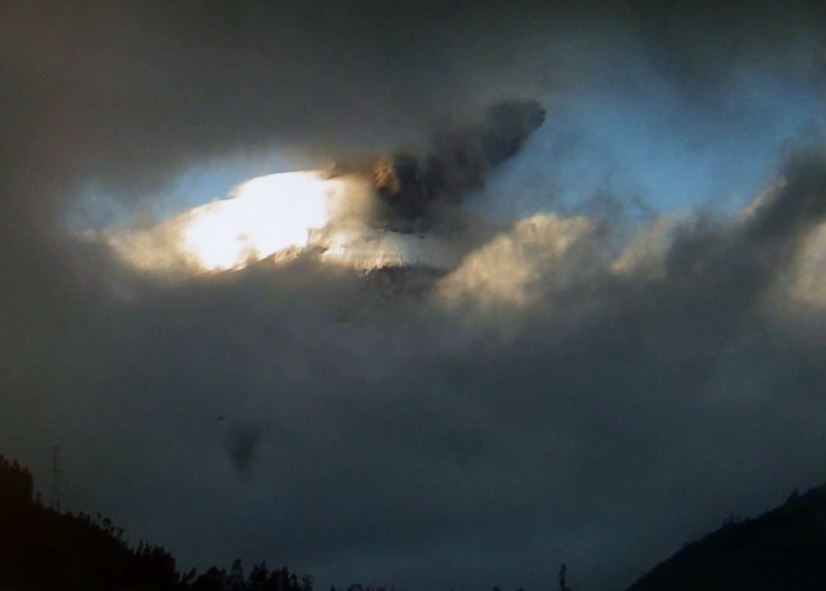
So after writing my previous blog, I headed to the Tungurahua Volcanic Observatory to learn how Ecuador’s Geophysical Institute monitors this active Andean volcano. Although it’s commonly obscured by clouds due to the prevailing easterly winds from the humid Amazonian lowlands, at times I could appreciate the amazing view the observatory offers.
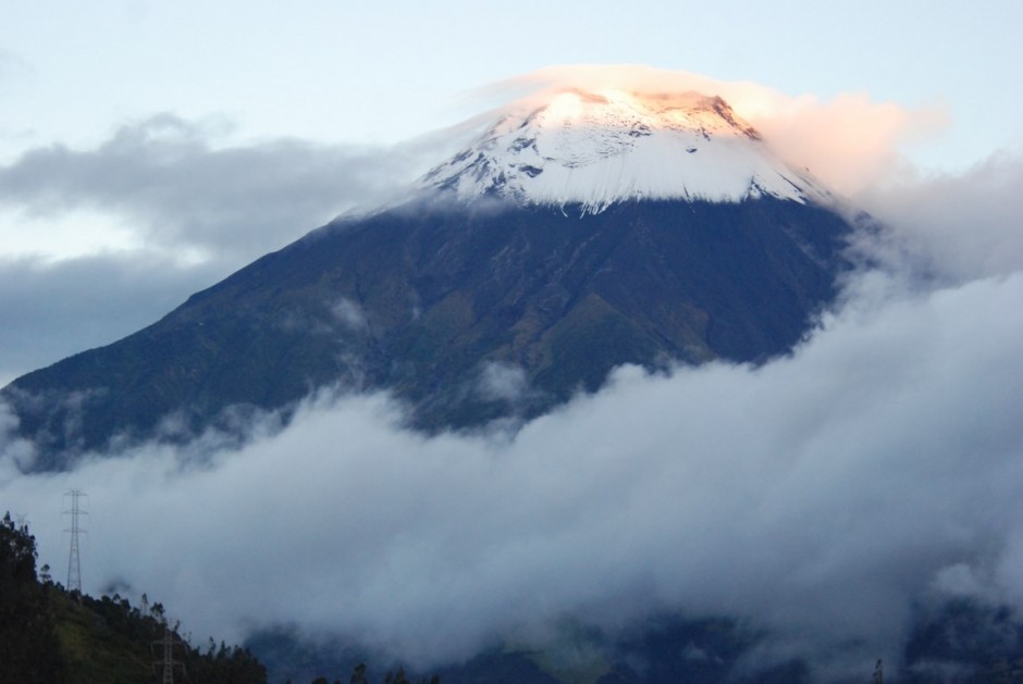
Tungurahua volcano, as viewed from the observatory
The observatory, located 13 km north of the crater, receives instrumental data from a range of seismic, infrasound, GPS, inclinometers, rain gauge and lahar-sensor stations dotted around the volcano. Workers keep an eye on their readouts and check against visual observations, while more detailed analysis takes places at the Quito offices. There is also a key role in maintaining radio contact with the vigías or lookouts who are unpaid members of the local community acting as eyes and ears on the ground. Even when the volcano is behaving there is a constant risk of lahars (volcanic mudflows) in the gullies from heavy rainfall mixing with the pyroclastic material. In fact my first bit of excitement was when a lahar alert was triggered by the AFM (acoustic flow monitor) system which is basically a localised high frequency seismometer calibrated to recognise the signal of passing water and/or material. However a vigía let us know it was just the heavy machinery clearing a landslide from the road and not to worry!
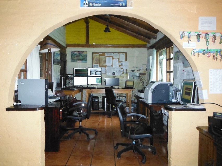
Monitoring room at the observatory
On 12 July I climbed with a small group to the highest seismic station at around 4000 m, 1023 m below the crater. The access via a muddy path through a tunnel of lush vegetation somewhat disguises from any visitor the frequently explosive nature of the volcano. However, I was still surprised when I needed to explain to two backpackers in shorts and no waterproofs at 3500 m that no, there was nowhere on the mountain to buy lunch! They were thrilled to discover they were on an active volcano that was actually prohibited to tourists at present. A little later when we’d only just started setting up the equipment, we received a call advising us to hurry up and descend. There was a notable increase in long period (LP) seismic signals indicating the movement of fluids perhaps only 1 km below us. Heading back, another backpacker was on his way up to spend the night on the volcano. Explaining the situation and why in no uncertain terms he should come back down with us had little effect as he told us that after walking all day, he had no intention of turning around, having ‘faith’ he would be ok.
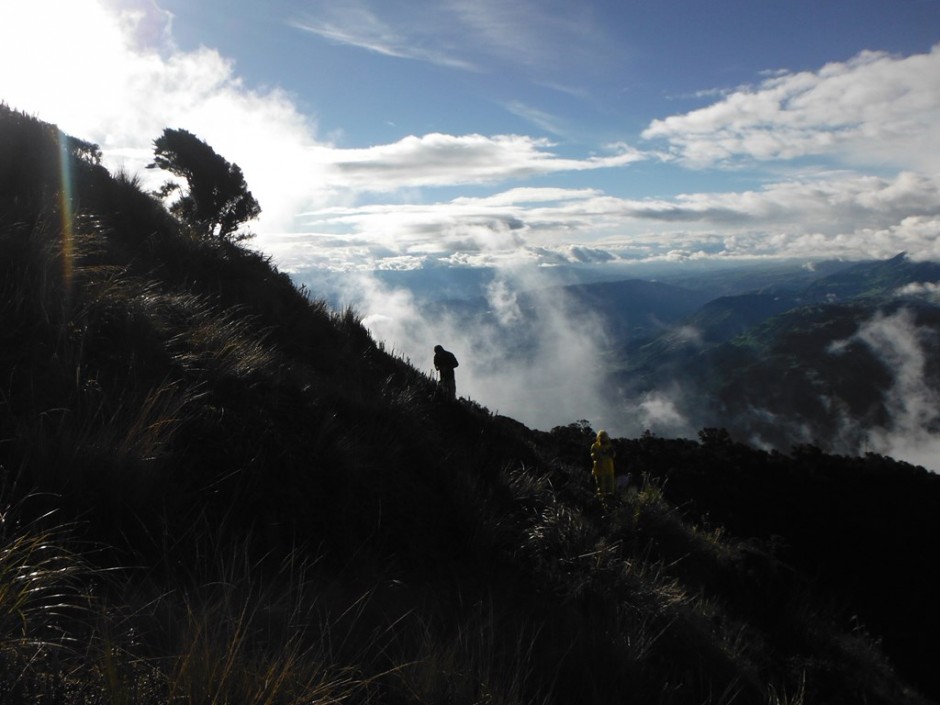
Setting up seismic and infrasound stations at 4000 m on Tungurahua volcano
About 36 hours later on 14 July at 6:45 am, Tungurahua showed why no one should put any faith in a volcano when an explosion shook the walls and windows of the observatory. Racing to the monitoring room, I looked out onto billowing charcoal-grey clouds. The short-band seismometer at the very same station was completely saturated as a roaring tremor continued for around 1.5 hours accompanied by cannon-shot type bangs every second or two. The team managed a constant stream of reports from the vigias, kept contact with the government bodies responsible for emergency management, and managed the media who didn’t take long before turning up.
The start of the eruption as recorded on a fixed camera at the observatory
The eruption was Vulcanian in style, involving the build-up of pressure before rock fractured to open the vent, producing an eruptive column of about 8 km and pyroclastic flows down the gullies, two of which reached a distance of ~6.5 km. One of these crossed a road where had it been a week day, children might have been crossing on the way to school. The day after, with activity being fairly low, I went to visit the lower levels of the two main pyroclastic flows, still showing temperatures of up to 95 °C with the ash highly fluidised and saw that despite an on-going threat, people had returned to work in the fields barely metres away.
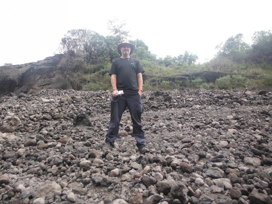
David stood on a pyroclastic flow deposit in the Juive Grande zone
Activity is continuing albeit to a lesser extent but to my knowledge, no one has been hurt. I hope all the visitors came down safely, but I was struck by a wish to improve information. The institute has some great hazard information on their website, but none in English and on my return to Quito they were enthusiastic about doing something about this. In just a few hours I was provided some basic Tungurahua facts for translation, and by the following day we had bi-lingual information for visitors up on the website. A small step that we plan to build on, but one I am so pleased to have been involved in.
I would like to thank the Insituto Geofísico for this opportunity, and to the Open University Ian Gass Bursary for providing financial support. Please let me know any comments or questions as I continue my experience over the coming weeks.
If you have any comments or questions you can get in touch with David through email or twitter (@litchfieldd).
John Tweedie
Another great article Dave.
It was really interesting reading about the hikers on the volcano. Is it really possible for a tourist to not realise they’re walking on an active volcano?
This, and the comment by the person who continued up the volcano made me wonder what could be done to alert people in the immediate area just to the nature of the volcano, maybe some form of information board if hikers tend to use the same paths up the volcano.
Will you be taking any video of the volcano or recording the sound? It would be great to hear those cannon like bangs!
David Litchfield
Hi John,
Apparently it is possible although hard to believe! My understanding is the restriction has been in place since current activity began in 1999 so some guidance by the trail might be overdue – although the route is not actually signposted as far I know. To be honest, I suspect (hope?) that those with absolutely no awareness at all are an extreme minority. As for the rest, well by the time they’ve got the start of the trail they may also feel ‘committed’. I also saw a group of 3 tourists with a local guide – would a board have stopped them after presumably paying an agency for their volcano experience? I saw signs of how the village of Pondoa just down from the trail had tried to develop volcano tourism subsequent to 1999 although I think this hadn’t worked out for them. The economy of the town Baños is completely reliant on tourist income so there are conflicts of interest here too.
I may be able to get some video at some point, its being quiet and hiding behind clouds today! As for cannon shot, I only heard those on the more significant eruption on 14th July. Since then its been the occasional low rumbly roaring sound but a bit tricky to capture.
David Litchfield
Couple of points I probably should have made in this blog I’d like to add here.
A blog post could never describe all the work done from the observatory in monitoring a volcano like Tungurahua – other areas I haven’t mentioned include thermal camera monitoring, monitoring of gas emisions, flights over the volcano and probably loads more I don’t even know about yet!
The other was to mention that all facts and figures in this report such as the pyroclastic flows are sourced from the Instituto Geofísico.
Pingback: Guest Blog: A Summer of Volcanic Observation in Ecuador (3) | Geology for Global Development