 Dr Susanne Sargeant works as a seismologist for the British Geological Survey. Susanne is undertaking work on the enhancement of knowledge exchange between earthquake scientists and NGOs for disaster risk reduction, preparedness and response. Her research is an excellent example of the integration of geoscience and development, and she is a member of GfGD’s Advisory Group. Here Susanne guest blogs for us about her recent trip to Bangladesh to run an earthquake risk management training course.
Bangladesh comes to meet us before we’re even out of the airport in Dhaka. The place is so full of energy and bustle it’s as if life is tripping over itself (and the luggage carousel) in its rush to be lived. Despite not being much bigger than England, Bangladesh is home to over 160 million people, and around 16 million live in Dhaka, the capital. In terms of natural hazards, Bangladesh is typically associated with destructive, sometimes devastating, cyclones and floods. The last major storm to affect the region was Cyclone Sidr in November 2007, which killed as many as 10,000 people.
What is generally less well known is that Bangladesh also has a long history of large, deadly earthquakes. This reflects the country’s position within the collision zone between India and Eurasia. The top ten largest earthquakes for Bangladesh and southernmost Himalayas, for which there are records, includes earthquakes in Chittagong (1762 8.0 M and 1865 6.8 M), Eastern Bengal (1868, 7.5 M), Lower Assam (1897, c. 8.7 M), Srimingal (1918, 7.6 M), northern Bangladesh (1923, 7.1 M), Dhubri (1930, 7.1 M). There have been no earthquakes greater than magnitude 7 since 1930 and the country is holding its breath for the next one…
Besides relatively high levels of seismic hazard, particularly in the east of the country, vulnerability to earthquakes is also high. General population increase, high levels of rural-to-urban migration, competition for space and the drive to maintain economic growth are (at least partly) responsible for rapid urban expansion, poor construction practices and the use of poor quality land. Vulnerability is increasing and there is significant potential for a massive earthquake-related disaster here.
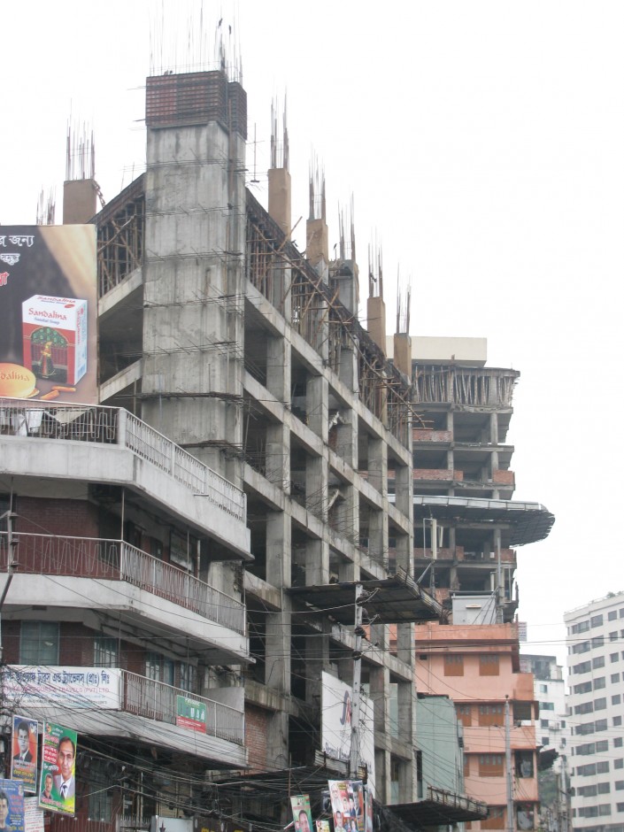
Typical construction in Dakha
As a seismologist at the British Geological Survey, and a NERC Knowledge Exchange fellow, my work focuses on finding ways to ensure that our scientific understanding of earthquakes has maximum impact on decision-making (from government to community level) and people’s behaviour. In Bangladesh I’m working with Concern Worldwide to increase the way in which earthquake information is used in their operations. In November 2012, I was in Dhaka with Willie McMartin, Operational Director for the International Rescue Corps (IRC), to deliver an earthquake risk management training course to country staff from Concern, Plan International, Oxfam, Save the Children, Islamic Relief and Action Aid.
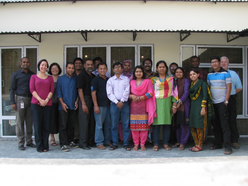
Participants on the earthquake risk training course
Willie worked as a fire officer in the UK for over thirty-seven years and is one of the founder members of the International Rescue Corps, a UK-based urban search and rescue charity. IRC regularly respond to a whole range of international disasters and since 1985 Willie has been involved in the response to twenty-four, including many earthquakes (e.g. Armenia 1988, El Salvador 2001, Gujurat 2001, Muzaffarabad 2005). Between us, we hoped that during the training it would be possible to increase general understanding of earthquakes and raise awareness of the earthquake threat in Bangladesh, consider the potential impact on these organisations, their staff and operations, and help the participants to be better prepared when an earthquake happens either at home or at work.
To be honest, it was a bit of an experiment. This is the first time that Willie and I have worked together (and the first time I had delivered any training) and we weren’t sure how our different fields of expertise would fit together. Luckily, we’re both happy to improvise and as it turned out, we (Willie, the participants and I) spent a really rewarding and enjoyable three days working together and learning from each other. In fact, we’ve now set up a working group so that we can continue to work together and share information.
As a hazard scientist, I learnt a valuable lesson too: living somewhere where a potentially devastating earthquake could happen is frightening – especially when you have no control over construction practices and compliance with building codes. That’s where someone like Willie comes in, with the experience and understanding to give people hope that there is something they can do to protect themselves and their families if an earthquake happens tomorrow. Implementing building codes and issues around non-compliance are tougher nuts to crack.
You can find out more about Susanne and Willies trip through the IRC blog.
You can read more about the vulnerability to natural disasters in Bangladesh here.
mahi
Hello, I think the blog is so nice and I wish that you will add more blogs so that we can learn geology.
learn geology
Hello, I think the blog is so nice and I wish that you will add more blogs so that we can learn geology.