Flo looks two examples of the strange and important ways that geology and where it’s located can affect international governance and regulation. From the presence of tiny coralline islands to ownership of the Arctic!
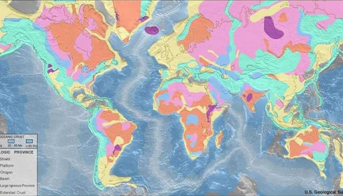
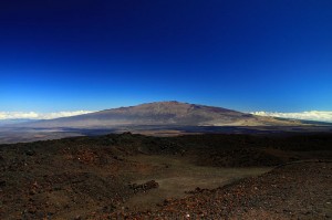
I’ve always had an interest in the peculiarities of geology and geomorphology and the inordinate (sometimes almost absurd!) ways that they play their part in deciding on big international governance. Humanity has long-relied on the presence of geological features such as mountain ranges, coasts, rivers etc. to delineate ownership and basis on which to set ‘ground rules’.These geological features account for many historic and modern day national borders and so the odd rock in the right place at the right time can be very handy (or not, depending on which side of the coin you’re on…). Sometimes this works well, countries such as India and Chile use enormous, previously impassable mountain ranges such as the Himalayas and the Andes as their natural borders and this has worked relatively well. Island states such as the UK assume their land borders at the point where land meets the sea, which also works for now but is ultimately just a function of current sea level. But in a dynamic world, the formation and loss of landmass and particularly changing sea levels will be shifting quite considerably in the face of human-induced climate change, and so the previously established rules and regulations about ownership and governance may start to become and bit less solid than it was…so where does this leave us?
I’m going to look at a couple examples of where geological features have influenced the distribution of governance responsibility among nations, and just how flimsy that burden of proof can get!
The Arctic
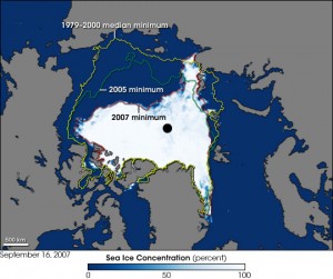
The image shows a record sea ice minimum in the Arctic, taken in September 2007. Image Credit – NASA, Wikimedia Commons.
One great example of how small, uncontrollable things can influence major decisions and changes, is the right to ownership and governance of the Arctic. The ongoing in reduction of sea ice in the Arctic due to climate change and recent developments in technology that would allow development of Arctic resources has led to something of an arms race with countries laying claim to large tracts of the region. The scientific basis for many of these claims is based on the mapping of ocean ridges and where they sit in relation to the Arctic states (Canada, US, Russia, Denmark, Finland, Iceland, Norway and Sweden).
The process for assigning areas of the Arctic is both scientific and political but nation states must prove through surveying that there is continuity and that they are geologically ‘attached’ to the Arctic by a ridge. The most recently lodged claim is that of Denmark, who, via Greenland a semi-autonomous Danish territory (another potentially fortuitous link in this chain), can lay claim to an area of 895,000 square kilometers due to the extension of the
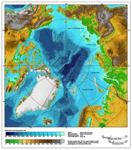
Bathymetric map of the Arctic Ocean. Image Credit – NOAA, Wikimedia Commons.
Lomonosov ridge, according to a senior geophysicist with the Geological Survey of Denmark and Greenland. Denmark has filed a claim to the area to the UN linked to the ridge, and if successful will have access to a sizable chunk of the Arctic’s resources. The regulation that covers these kind of claims is the U.N. Convention on the Law of the Sea which states that nations are entitled to a distance of 200 nautical miles from their coast, any claims beyond this reach need to be supported by scientific data. This most recent claim is the fifth from Denmark who have also previously submitted claims north of the Faroe Islands (another Danish territory) and in an area south of the Faroe Islands. This builds on a body of work where Danish scientists surveyed a 2000 kilometer long underwater mountain range that runs north of Siberia, they concluded that this ridge is geologically attached to Greenland. All of the submissions await consideration by the Commission on the Limits of the Continental Shelf , the Danish statement currently overlaps with with Norway’s continental shelf beyond 200
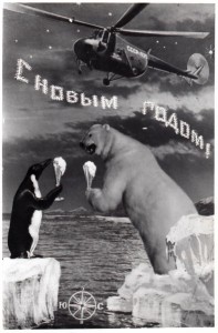
A USSR postcard depicting Soviet dominance of the Arctic! Image Credit – kristofer.b, Wikimedia Commons.
nautical miles and there are also potential overlaps with claims by Canada, Russia and the U.S.
Some people involved in the process had hoped that control of the Arctic would be decided on through a ‘Gentleman’s agreement’ rather than the tough negotiations that will now ensue.
The United Nations panel will eventually decide control of the area, and the sea floor boundaries will be settled by international negotiations but this process won’t begin until the scientific data has been examined. This is expected to take 10-15 years, by which stage the politics around accessible resources in the Arctic will have intensifed due to increased global warming creating easier access to many of the oil and mineral reserves, so this topic isn’t going away!
Okinotori Islands
This tiny uninhabited set of islands, 1100 miles south of Tokyo in the Phillippine Sea is currently also responsible for lending control of a 160,000-square-mile economic zone in the surrounding waters. The most southerly of Japan’s landmass is only 7 miles around and it is just, and only just, keeping its head above water. Herein lies the problem, according the the UN’s ‘Law of the Sea’ ( useful but problematic bit of regulation), any claim to an exclusive economic zone, (such as Okinotorishima, or ‘distant bird island’) like the one in Japan is
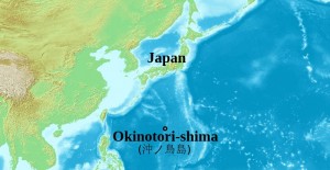
Location of the Okinotorishima islands in the Phillippine Sea. Image Credit – ForestFarmer, Wikimedia Commons.
dependent on the existence of a habitable island landmass existing in the area. If this island sinks beneath the water then the whole claim to the economic zone sinks with it, along with important mineral and fish resources for Japan. The claim, even if the islands stay above water isn’t uncontested, China disputes the ownership stating that the islands are just a cluster of uninhabitable rocks and doesn’t fulfill the requirement of ‘habitable’ at all! While it’s true that no one lives there, the small area is host to a small man-made islet with a platform which is used as a weather monitoring station with a building that houses researchers.
The usefulness (and contention) of these islands and their slow sinking has not bypassed the Japanese government who have set up programs (and considerable investment) to keep the islands bobbing above sea level. The project to keep the island above water is two-fold, the Japanese government have installed protection around the island in the form of cement, steel blocks and titanium mesh to protect from erosion and the increasing number of tropical storms.
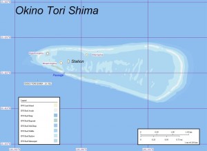
Map of Okino-Torishima, Pacific Ocean. Image credit – Ratzer, Wikimedia Commons.
However the ‘sinking’ is not just due to erosion and damage but also due to the low production of coral. This is thought to be due to the warmer waters in the area lowering coral growth. This loss of landmass and the important politics associated with it has meant that several agencies have made it a priority to revitalise the growth of corals, although it’s not quite that simple! This involves applying a method of sexual reproduction developed over the past 20 years to cultivate corals. According to the fisheries agency, about $19 million ( of tax payers money…) has been spent to breed about 100,000 coral plants using the method with a success rate of approximately 20%. It remains to be seen whether this rock, doctored or otherwise, will be in the right place for the Japanese authorities in years to come…..
It’s worth reflecting that with both these examples, not only are they wholly reliant on the location of bits of geology to define long-lasting rules, regulations and potentially economic opportinities that can make or break countries but also these rocks (in a geological sense) are totally transient, and the ridges that secure the Arctic and the corals that secure the economic zone for Japan just happened to be in the right place at the right time. Throw in an exntending ridge of a destructive plate margin somewhere else and this fragile hierarchy would be thrown into disarray.
Further Reading
BBC News – Denmark challenges Russia and Canada over North Pole.
Phys.Org – Denmark claims North Pole link via Greenland ridge link
NPR.org – Denmark Claims Part Of The Arctic, Including The North Pole
Global News – Denmark claims North Pole through Arctic underwater ridge link from Greenland
New York Times –Growing Coral to Keep a Sea Claim Above Water
You Tube – China refutes Japanese claim about Okinotori Reef as island
Asia-Pacific Journal – Japan Focus – The US-Japan-China Mistrust Spiral and Okinotorishima

