J ack Williams is a PhD Student at the University of Otago, New Zealand, where he is studying the Alpine Fault. Jack was part of a team of experts that went into the field immediately following the Kaikoura earthquake to map the surface ruptures. Here he explains what they were up to and shares some photos of the damage.
The Mw 7.8 Kaikoura Earthquake was an incredibly complex event involving several faults; and to unravel its movement we need accurate maps of the surface ruptures that slipped during the earthquake. A team from the University of Otago comprising myself, Mark Stirling, Kat Sauer and David Barrell (GNS Science) spent the past week mapping the Hundalee Fault, where helicopter reconnaissance flights had tipped us off about surface ruptures. This fault lies close to the epicentre of the Kaikoura event, but to the south of the Kekerengu Fault, across which ~10 m displacement has been widely reported.
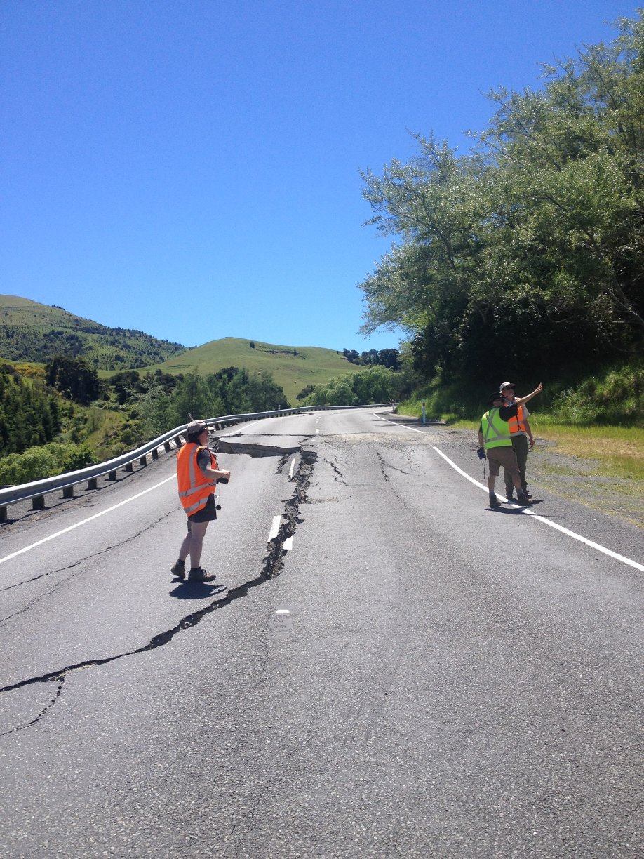
In this photo of State Highway 1 (SH1), tensional cracks formed around the scarp from gravitational deformation induced by ground shaking in the earthquake
‘Crevasses’ in road
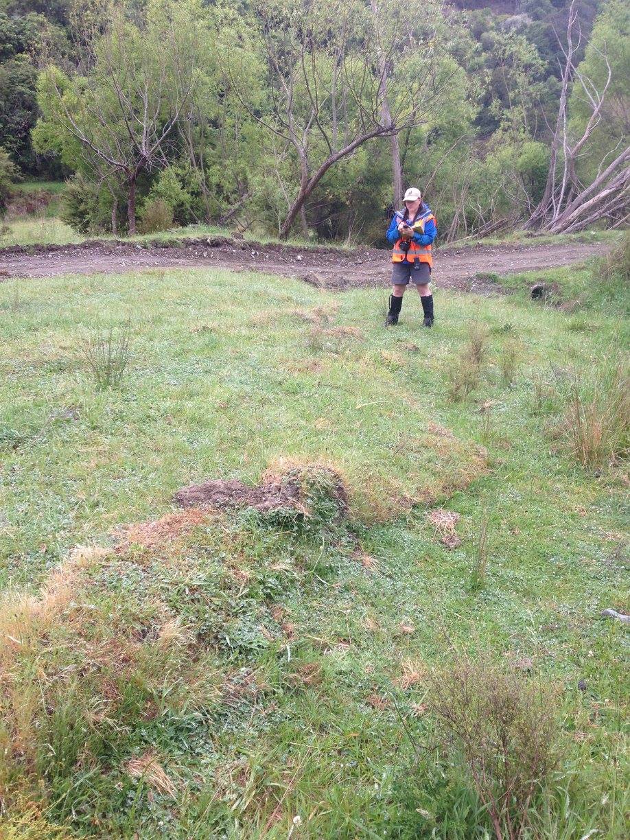
The observations that needed to be made included: measuring displacement across the fault, constraining the length of surface rupture along-strike of the Hundalee Fault, and whether we could identify previous events along the sections that ruptured on the 14th of November. ‘Surface rupture’ refers to places where the earthquake rupture broke through to the surface and caused offset across recognisable markers such as roads and fence posts.
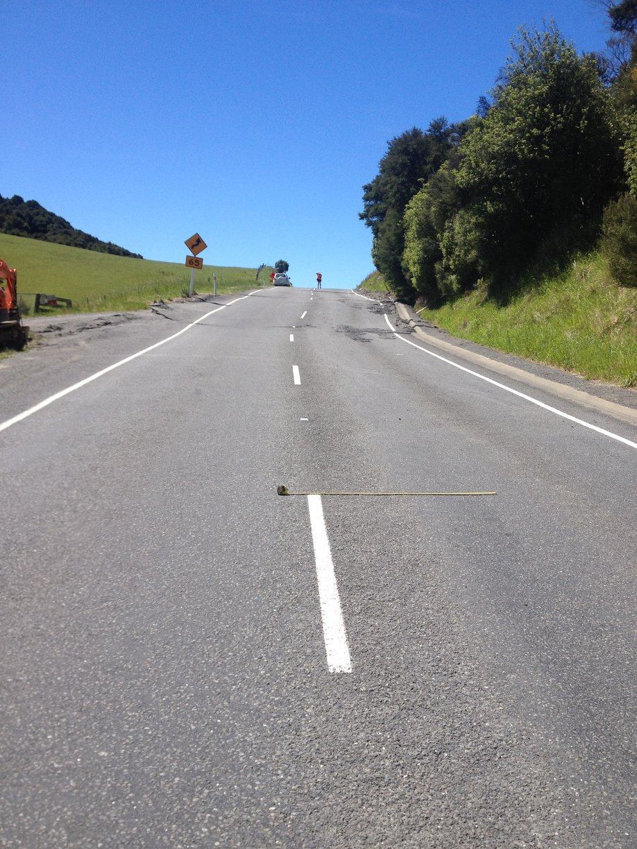
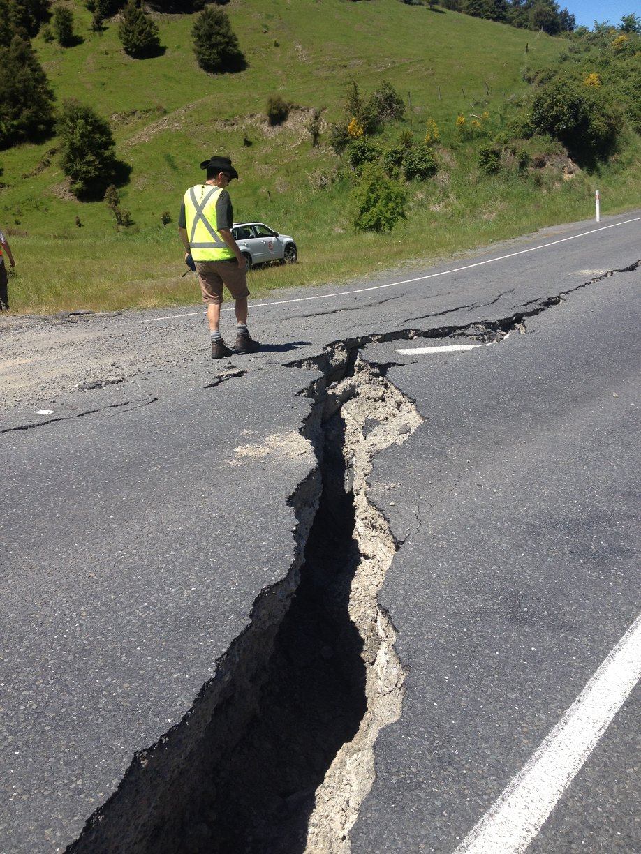
Here the offset was a combination of uplift with the far side of the road uplifted 1 m, and dextral, meaning that the far side of the road moved horizontally to the right (as can be seen in the centre road markings). This type of movement with two components, is referred to as ‘oblique-slip’ and has been recognised across the Kaikoura Earthquake
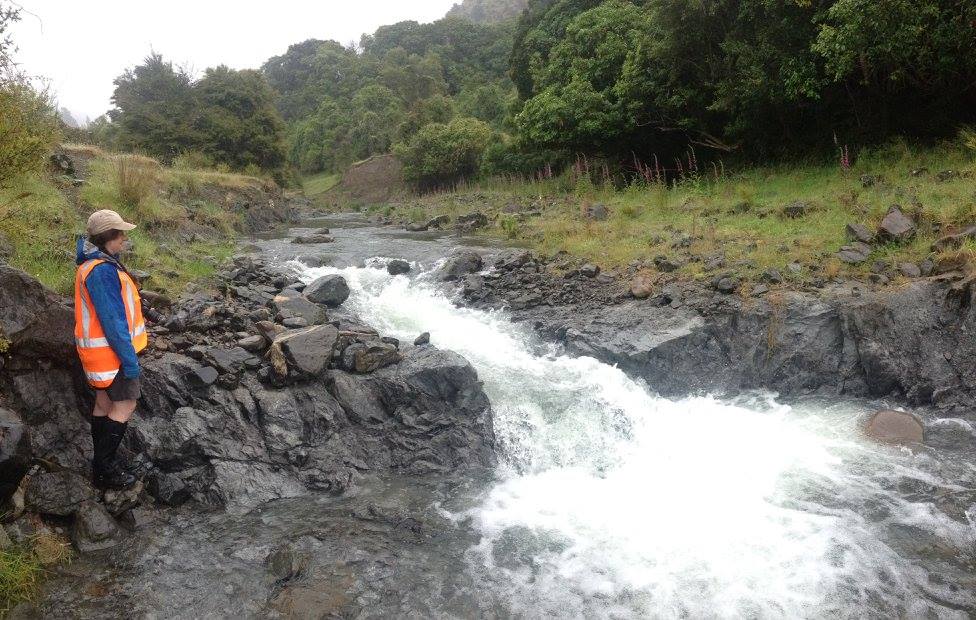
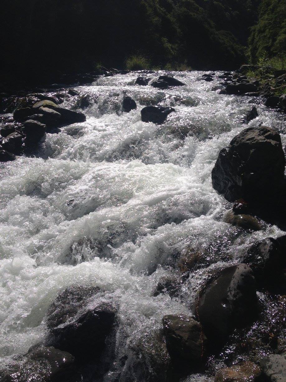
Surface rupture crossing the Te Moto Moto Stream. These rapids likely weren’t here a few weeks ago!
Mark has been busy accurately mapping the fault trace using a Real Time Kinematic (RTK) GPS, whilst Kat and myself have been getting to grips with the department Unmanned Aerial Vehicle (UAV, i.e. a drone) to capture birds-eye views and videos of the surface rupture. By taking overlapping photos, we hope to generate 3D photogrammetry models of the ruptures. We have also seen bedrock exposures of the Hundalee Fault across a creek that was uplifted ~1 m during the earthquake, with exceptional examples of gouges and cataclasites, including some cataclasite strands that did not appear to slip in this event.
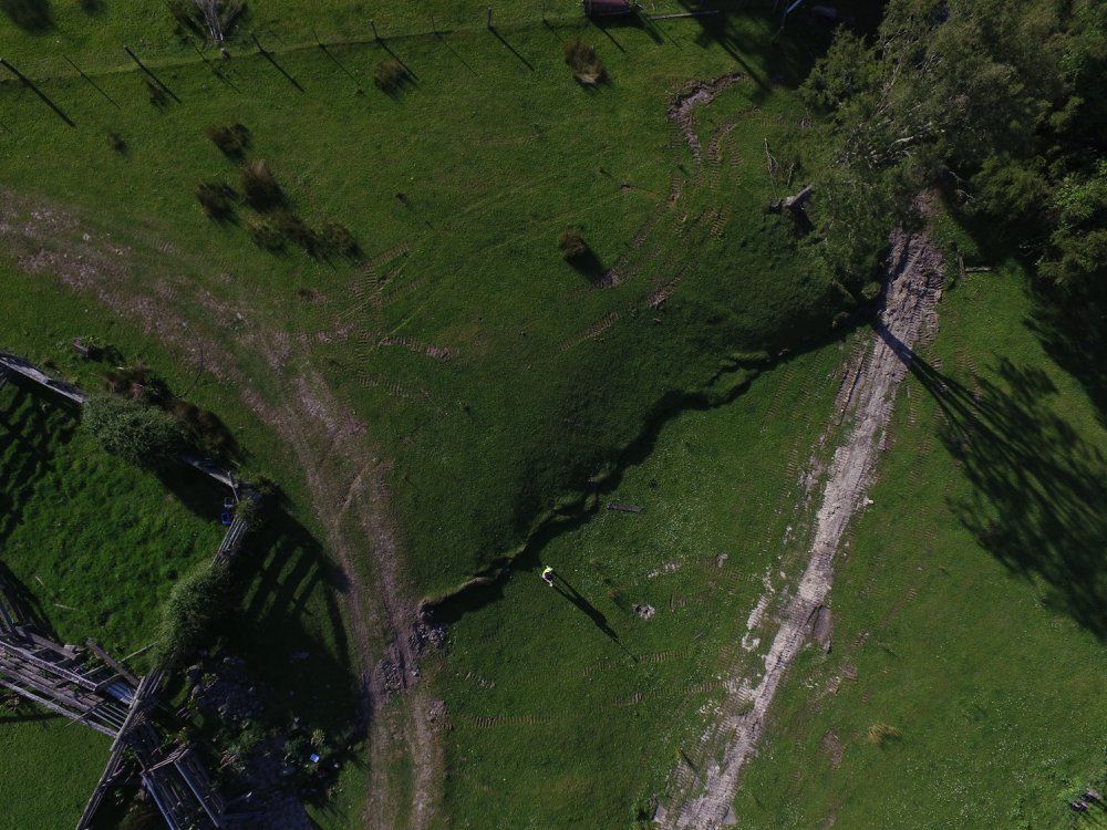
A drone’s eye view of the surface rupture
These results will feed into the larger scale picture that is beginning to emerge from this earthquake, and will no doubt keep us busy for many years ahead. For example, why in some locations do we observe sinistral offset on a fault that predominantly has dextral offset, and, what is controlling the segmentation and jumps in the ruptures we have identified? From a personal point of view, it has been an eye opening experience into a side of earthquake geology I have never dealt with before, and also the importance of the science community engaging with those who have been affected with this event.

Landslide covers the rail tracks that run along the east coast of the South Island.
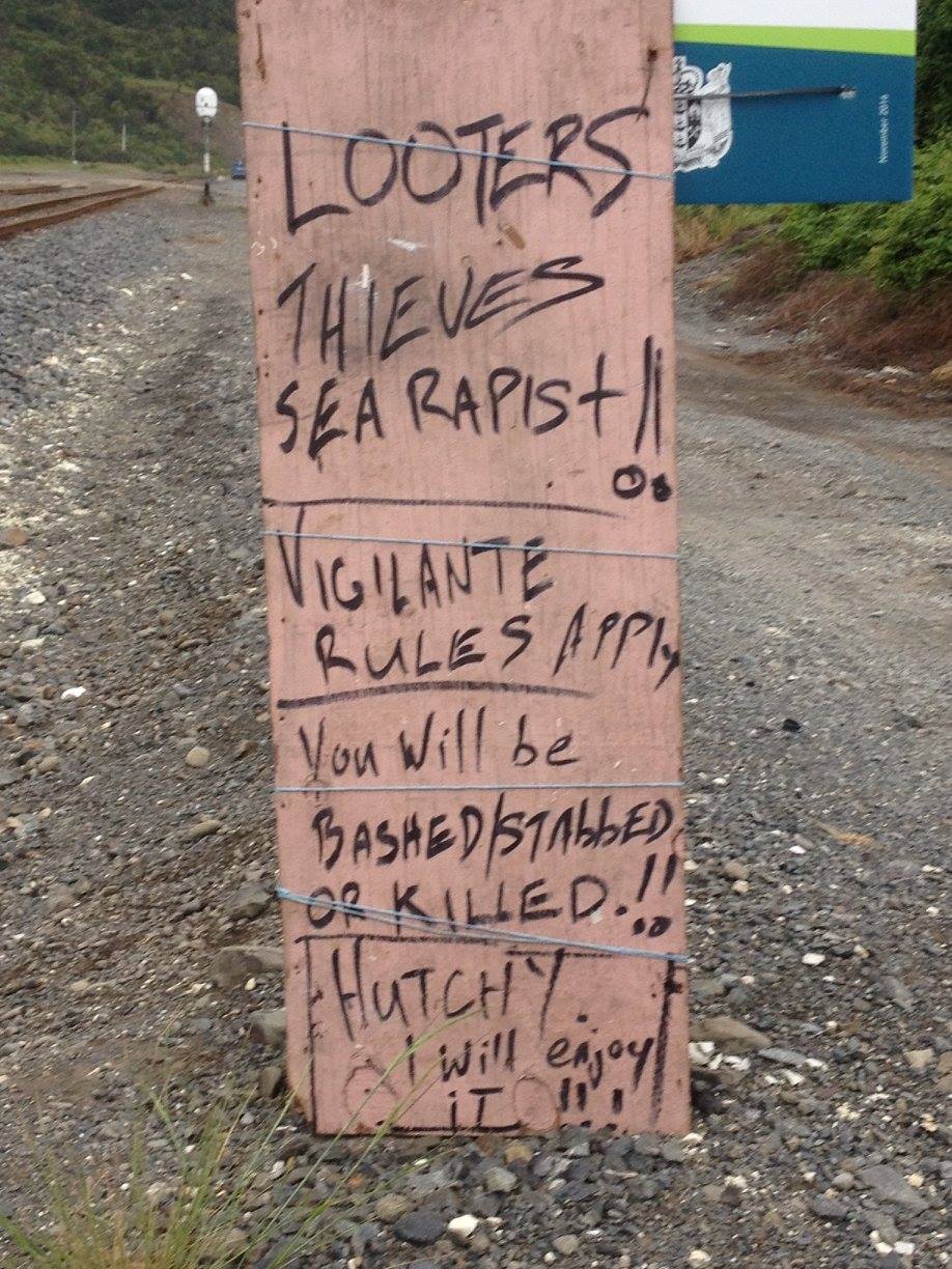
A bold warning from a local resident affected by the earthquake.