EGU Blogs

Yukon

Thaw Slumps of the NWT

I recently across an article that reminded me of my field work days in the early stages of my PhD in the Canadian Arctic at retrogressive thaw slumps. The article discusses the impending catastrophic drainage of a lake when the thin strip of land separating it from a thaw slump fails (see article), which it will inevitably do very soon. The story has now been picked up all across Canada in the context of climate change and permafrost melting. It was nice to see thaw slumps and permafrost in the news so I thought I’d post a few of my own pictures of these slumps from a few years ago that are very nearby the one in the article. Actually, we worked on these same slumps with Dr. Steve Kokelj from the NWT geological survey who is quoted.

Here are few of my own slump pictures from my fieldwork days in the NWT.
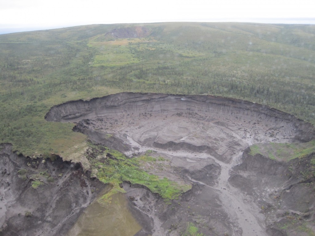
IMG_2860

An aerial view of the Charras slump, which is approximately 1 km across and 30m deep at the headwall. (Photo: Matt Herod – 2011)
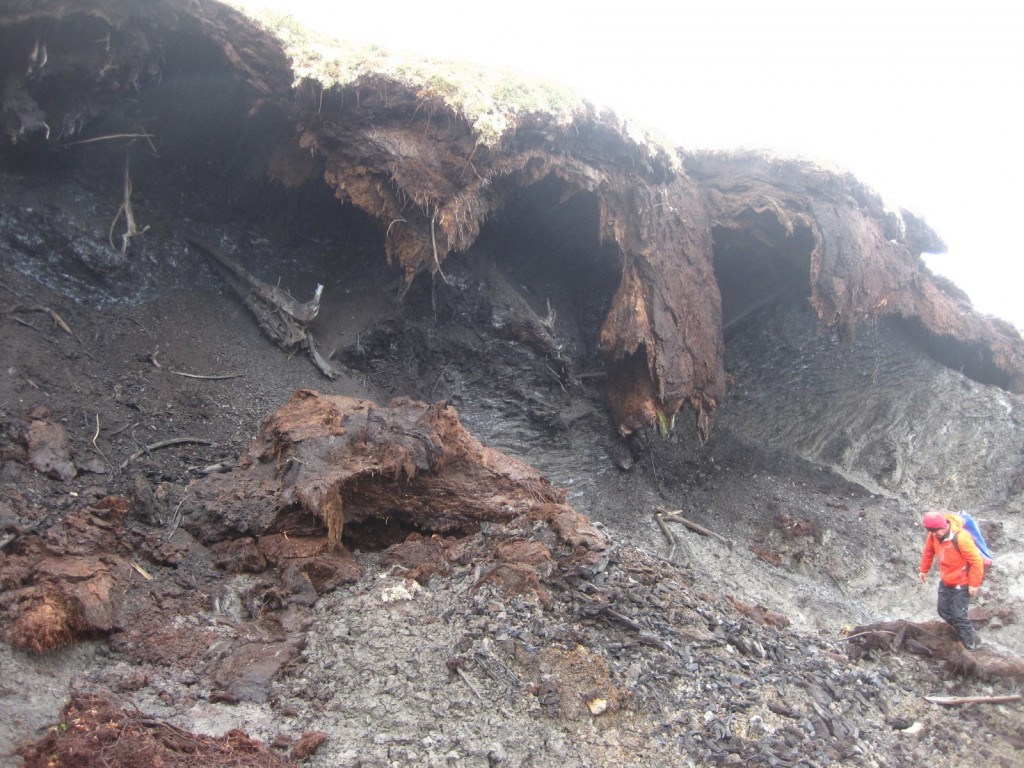
IMG_2855

An aerial view of one of the smaller slumps. (Photo: Matt Herod – 2011)

IMG_2830

My colleague, Bernard, from the uOttawa geography department headed towards the headwall for an ice sample. (Photo: Matt Herod – 2011)
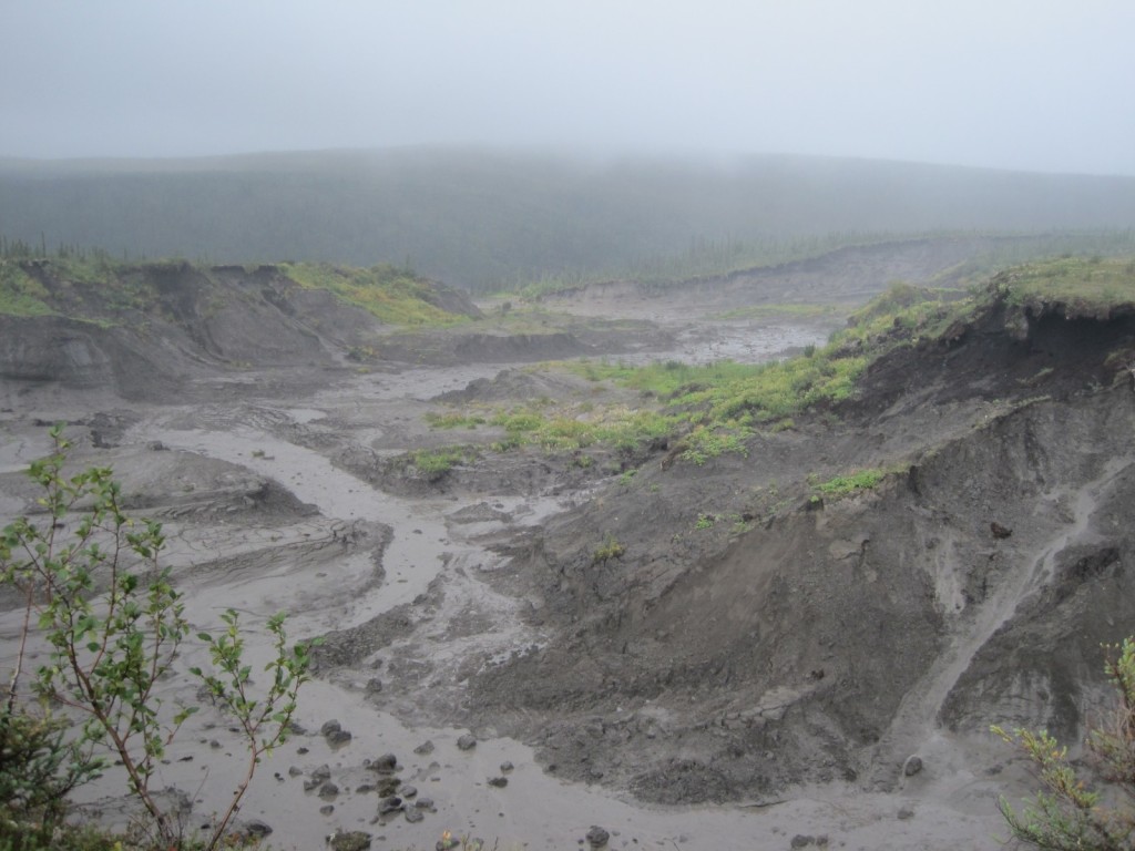
IMG_2817

A rainy day in the slump. The mudflow becomes really active when the weather is wet. (Photo: Matt Herod – 2011)

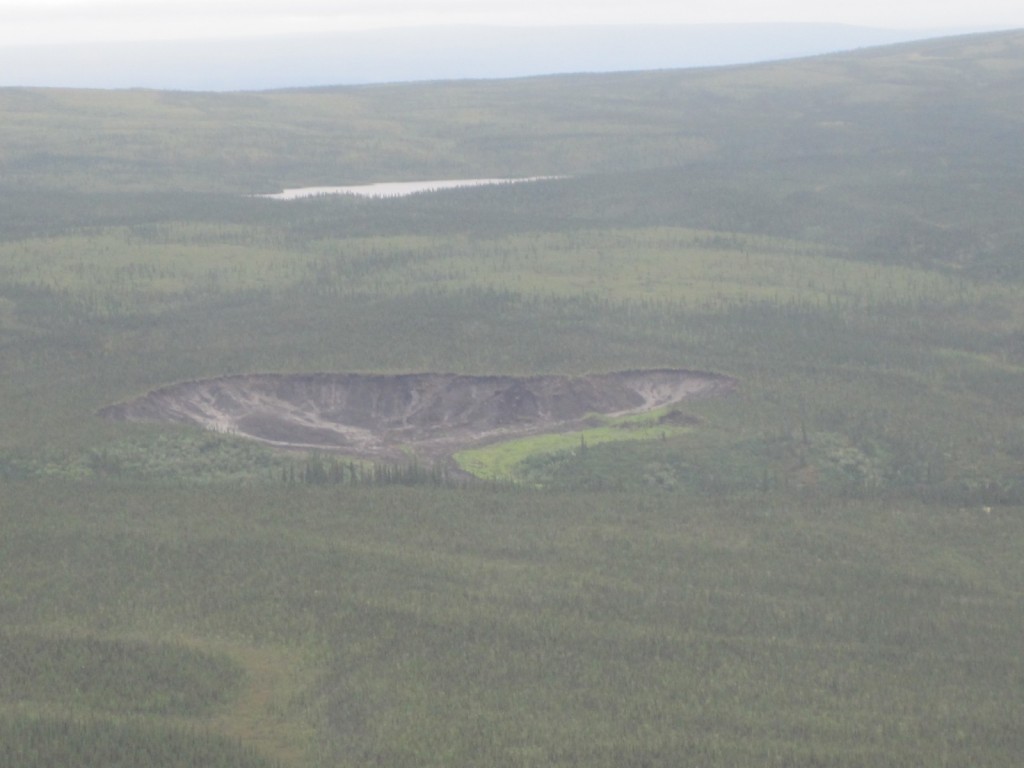
 

Geology Photo of the Week #40

The 40th edition of the photo of the week highlights the mudlfow from a retrogressive thaw slump near Fort McPherson in the Northwest Territories, where I did field work for a few weeks in 2010 and 2011.

The first photo in this series highlights the slump itself. I took this photo from a helicopter and the entire slump is approximately 1 kilometer wide and has 3 lobes. The mudflow starts where everything converges. I have been told by people who have been back that the slump does not look anything like this today and it is approximately 30-50% larger!

IMG_1545

Photo: Matt Herod

The next photo shows the convergence point in the top right and the start of the mudflow as it moves down the valley. There is so much mud that the little stream that once flowed in the valley has been completely dammed and formed a lake.

IMG_1544

Photo: Matt Herod

The final photo in the series shows the rest of the mudflow, which extends for about 10 kilometres down the valley.

IMG_1548

Photo: Matt Herod


Geology Photo of the Week #39

I have been a bit lax with the photo’s of the week lately. Sorry about that! Here is a nice one from last year’s field season showing a cute little marmot sitting on an erratic with a great vista behind him.

IMG_3390

(Photo: Matt Herod)

IMG_3391

The little guy stuck around long enough for me to get a close-up. (Photo: Matt Herod)

Cheers,

Matt

Geology Photo of the Week #35

This edition of the photo of the week highlights something I feel that I should have explained a long time ago: my banner photo. The banner photo above is more than just a pretty picture. It actually illustrates, very beautifully, a truly interesting phenomenon that can be encountered in Arctic watersheds. I speak of the aufeis, pronounced oh-fyse, which is the giant sheet of ice covering the river. Aufeis form in one of two ways. The first is when an ice dam forms in a river and water piles up behind it and then overflows and freezes upward creating an aufeis. The second is when aufeis occur at points of groundwater discharge into a river. Groundwater, which has a much higher temperature than surface water during the winter can discharge year-round. Therefore, it continues to discharge even when temperatures are well below freezing. However, when it discharges into the frigid temperature of an Arctic winter it rapidly freezes causing the development of an aufeis at the discharge point, which is the case in the pictures below. It is possible to distinguish the two types of formation by analyzing the stable isotopes of 18O and 2H in the ice to determine its source: groundwater or river water.

A beautiful panorama of the Tombstone Mountains and the North Klondike River with an aufeis on it in May 2010. (Photo: Matt Herod)

Getting a closer look at the aufeis. You can start to see the layering within the ice. (Photo: Matt Herod)

A nice pic showing all of the ice layers within the aufeis. In the past these have been samples for their isotopic composition as part of groundwater studies.(Photo: Matt Herod)

These aufeis are relatively small. Only a few sqaure kilometres max. However, they can grow into massive ice bodies. The largest known is at the Moma River, Siberia and is between 70 and 110 km^2 (Clark and Lauriol, 1997).

One of my all time favourite pictures shoing the Tombstone Mountain range in the fall of 2011. On the left you can see the river and all the braided channels that are covered by the aufeis in the pictures above. (Photo: Matt Herod)

Cheers,

Matt

Clark, I. D., & Lauriol, B. (1997). Northern Aufeis of the Firth River Basin, Northern Yukon, Canada: Insights into Permafrost Hydrogeology and Karst. Arctic and Alpine Research, 29(2), 240–252.