EGU Blogs

Divisions

AS
Atmospheric Sciences

Buckle up! Its about to get bumpy on the plane.

Buckle up! Its about to get bumpy on the plane.

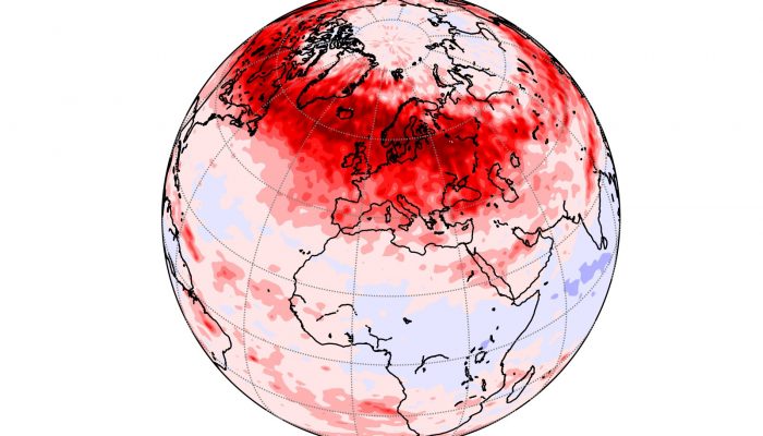
Clear-Air Turbulence (CAT) is a major hazard to the aviation industry. If you have ever been on a plane you have probably heard the pilots warn that clear-air turbulence could occur at any time so always wear your seatbelt. Most people will have experienced it for themselves and wanted to grip their seat. However, severe turbulence capable of causing serious passengers injuries is rare. It is defi ...[Read More]

CR
Cryospheric Sciences

Mapping the bottom of the world — an Interview with Brad Herried, Antarctic Cartographer

Mapping the bottom of the world — an Interview with Brad Herried, Antarctic Cartographer

Mapping Earth’s most remote continent presents a number of unique challenges. Antarctic cartographers and scientists are using some of the most advanced mapping technologies available to get a clearer picture of the continent. We asked Brad Herried, a Cartographer and Web Developer at the Polar Geospatial Center at the University of Minnesota, a few questions about what it’s like to do this unique ...[Read More]

GD
Geodynamics

Poster presentation tips

Poster presentation tips

Being a scientist is more than just doing research and science. You also need to be able to communicate your findings to your peers and/or the general public (outreach). At conferences, you usually have two options for presenting your work: a talk or a poster (although at EGU, you also have the PICO sessions). A poster is often preferred if you would like to start a discussion and get lots of feed ...[Read More]

CR
Cryospheric Sciences

Image of the Week – The true size of Greenland

Image of the Week – The true size of Greenland

Greenland is a critical part of the world, which is regularly covered on this blog, because it hosts the second largest ice body on Earth – the Greenland Ice Sheet. This ice sheet, along with its small peripheral ice caps, contributes by 43% to current sea-level rise. However, despite being the world’s largest island Greenland, appears disproportionately large on the most common world maps (Fig. 2 ...[Read More]

GD
Geodynamics

The lost Tethyan seaways: A deep-Earth and deep-time perspective on eastern Tethyan tectonics

The lost Tethyan seaways: A deep-Earth and deep-time perspective on eastern Tethyan tectonics

Every 8 weeks we turn our attention to a Remarkable Region that deserves a spot in the scientific limelight. Following from the first entry which showcased the Eastern Mediterranean, we move further east, and back in time, to the realm of the Tethys. The post is by postdoctoral researcher Sabin Zahirovic of the EarthByte Group and Basin GENESIS Hub, The University of Sydney. The southern and south ...[Read More]

Geochemistry, Mineralogy, Petrology & Volcanology

Ongoing unrest at Agung Volcano, Indonesia

Ongoing unrest at Agung Volcano, Indonesia

Agung volcano, a 3.1 km high cone located in the east of Bali, Indonesia, which last erupted in 1963 killing ~1500 people (Self and Rampino, 2012), is currently undergoing seismic unrest, and steam/gas emissions have been observed at the surface. This has led the Indonesian authorities to evacuate areas around Agung which could be affected by volcanic hazards, leading to the displacement of over 7 ...[Read More]

BG
Biogeosciences

Identification of past methane emission altering the foraminiferal tests by secondary overgrowth of calcium carbonate.

Identification of past methane emission altering the foraminiferal tests by secondary overgrowth of calcium carbonate.

Ever heard about foraminifera? These tiny benthic (living at the seafloor) marine organisms are common in oceans across the globe and can be used to accurately give relative dates to sedimentary rocks. But we can also use them to identify past methane emissions from the seabed by studing their test or shell!   The measurements were done on foraminifera called Cassidulina neoteretis , which is a ty ...[Read More]

CR
Cryospheric Sciences

Image of the Week: Petermann Glacier

Image of the Week: Petermann Glacier

Our image of the week shows the area around the calving front of Petermann Glacier through the spring, summer, and autumn of 2016. Petermann Glacier, in northern Greenland, is one of the largest glaciers of the Greenland Ice Sheet. It terminates in the huge Petermann Fjord, more than 10 km wide, surrounded by 1000 m cliffs and plunging to more than 1100 m below sea level at its deepest point. In 2 ...[Read More]

Geochemistry, Mineralogy, Petrology & Volcanology

Unseen but not unfelt: resilience to persistent volcanic emissions

Unseen but not unfelt: resilience to persistent volcanic emissions

The last decade has been inundated with reports of environmental disasters impacting the lives of billions of people around the world.  While news coverage of floods, hurricanes, earthquakes or wild fires are always accompanied with spectacular images of destruction that emphasise the speed at which they strike, a myriad of slow and latent hazards have been left in the shadow of the public attenti ...[Read More]

GD
Geodynamics

The EUGEN e.V. meeting – a unique (geological) experience

The EUGEN e.V. meeting – a unique (geological) experience

Extracurricular activities for current and former geosciences students provide great value to early career scientists in terms of networking and broadening their scientific horizon. PhD student Maximilian Döhmann, who studies rock deformation with numerical models based on high temperature and pressure torsion experiments in the Geodynamic Modelling group of GFZ Potsdam, shares his experiences wit ...[Read More]