A tweet from Jenni Barclay about a Pirate Scientist gave me an excuse to visit the newly opened reading rooms in the Bodleian’s Weston Library..
William Dampier was a seventeenth century pirate, and later maritime adventurer, whose several books of ‘Voyages and Discoveries’ make for fascinating reading. In 1699, he set sail in HMS Roebuck to try and find Terra Australis, a mythical ‘southern continent’. His journey took him past the Cape of Good Hope to the north-western coast of New Holland (now Australia), and then on to Timor, New Guinea, and New Britain. On the way back, he only got as far as Ascension island, in the Atlantic, before his ship sprung a leak and had to be abandoned. His crew were rescued some weeks later by a party of British naval ships on their way to Barbados.
In the preface to his 1703 book ‘A Voyage to New Holland..’ he writes ‘The world is apt to judge of everything by the success, and whoever had ill fortune will hardly be allowed a good name. This, my Lord, was my unhappiness in my late expedition in the Roebuck, which foundered thro’ perfact age near the island of Ascension. I suffered extreamly in my reputation by that misfortune..’

Part of the preface to Dampier’s ‘Voyage to New Holland’. Bodleian ms. 8 S 43 Jur
Despite his pessimism over the loss of the ship, and his failure to reach Terra Australis, the expedition was a great success as a ‘voyage of discovery‘. Dampier’s book has some lovely descriptions of active volcanoes that he encountered to the east of Timor island – part of what we now call the Banda Arc – and of others along the north coast of (Papua) New Guinea, part of what is now known as the Bismarck Arc. Several of his reports of volcanoes that he encountered are the earliest written records of activity.
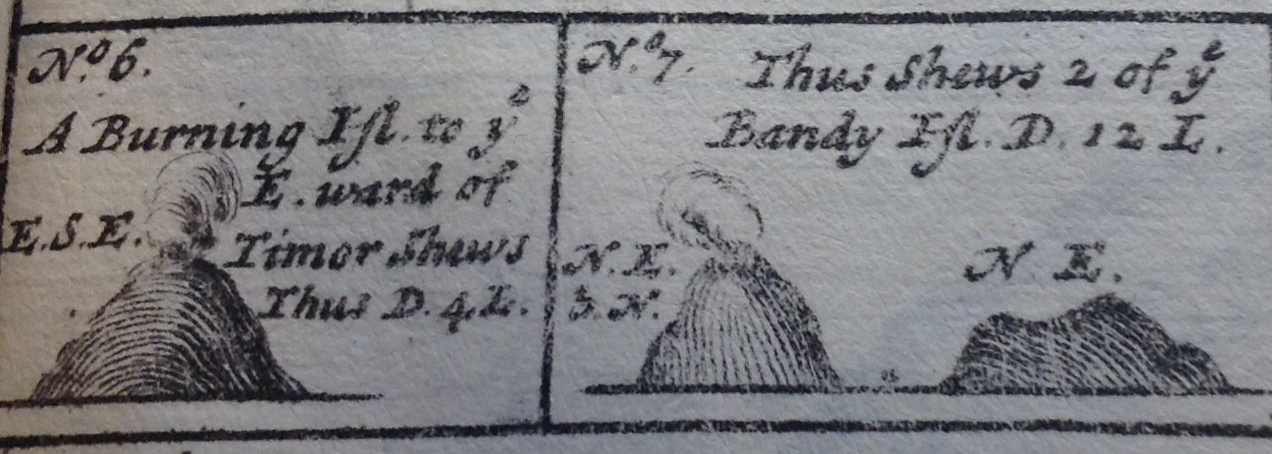
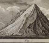
Banda island volcanoes – likely Wurlali and Banda Api. ‘No 6. A burning island to the East of Timor shows thus. Distance 4 leagues.’ ‘No 7 Thus shows 2 of the Bandy islands. Distance 12 leagues.’ 1 league is 3 nautical miles. Bodleian ms. 8 S 43 Jur
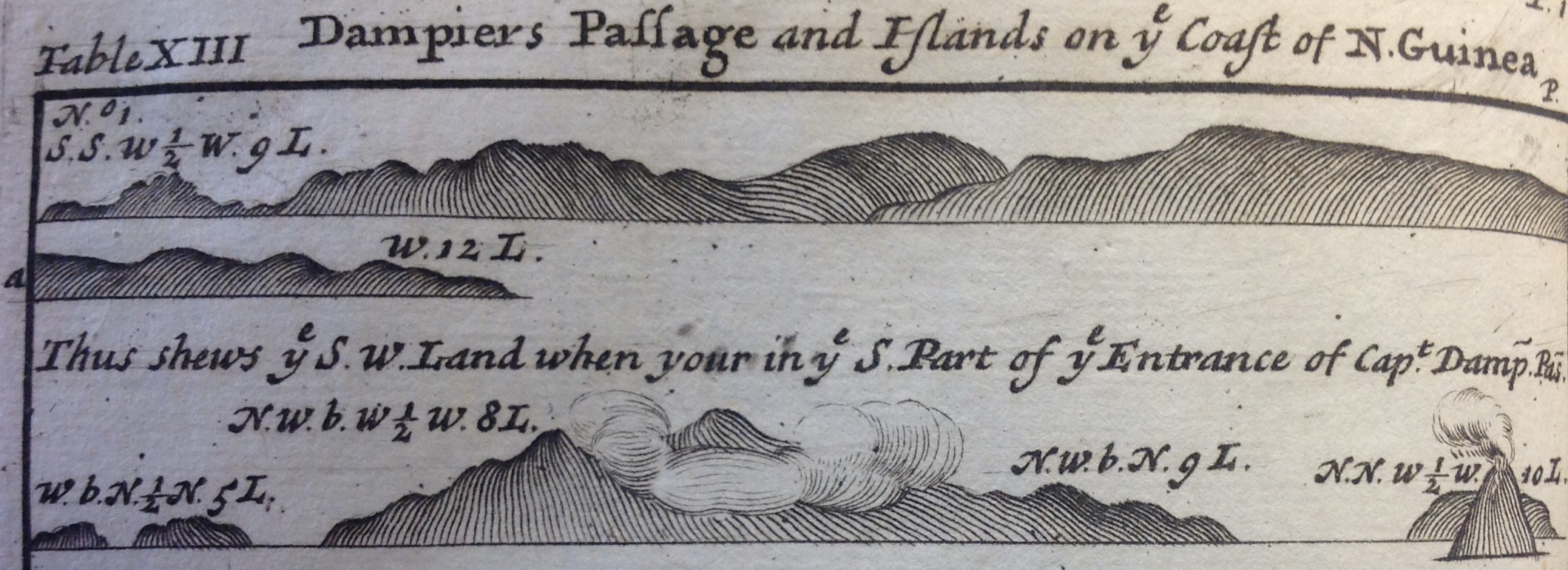
On 13 Dec 1699, the Roebuck sailed from Babao, east past Timor towards New Guinea. On December 27th ‘ we saw the burning island.. It lies in lat 6 deg 36 minutes. It is high but small. [The top] is divided in the middle into two peaks, between which issued out much smoak’. This is most likely Wurlali volcano, on Damar island, Indonesia. Later they sailed past another burning island, most likely Banda Api. Then around the northern coast of present day Papua New Guinea, they encountered several volcanoes of the New Guinea arc. Wally Johnson has interpreted this portion of Dampier’s trip in his recent book Fire Mountains of the Islands, and identified several of Dampier’s unnamed ‘burning islands’.
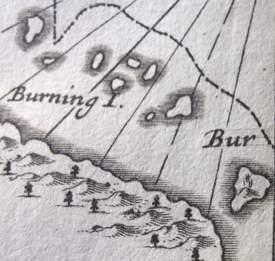
Two Burning Islands offshore from the northern coast of Papua New Guinea – most likely Kadovar (to the north), and Karkar (to the south). Bodleian ms. 8 S 43 Jur
On the 24 and 25th March 1700, Dampier spent some time watching an eruption, now thought to be of Ritter Volcano which lies in the straits between Papua New Guinea and New Britain
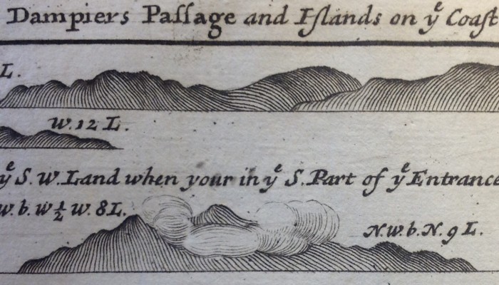
Dampier’s passage between New Guinea and New Britain. The erupting volcano (far right) is Ritter island. Bodleian ms 8 S 43 Jur
‘At ten o clock I saw a great fire, blazing up in a pillar, sometimes very high for three or four minutes.. In the morning I found out that the fire we had seen was a burning island, and steered for it.’ ‘March 25th the Island all night vomited fire and smoak very amazingly and at every belch we heard a dreadful noise like thunder and saw a flame after it. The intervals between its belches were about half a minute. Some more, some less, neither were these pulses of eruptions alike, for some were but faint convulsions in comparison of the more vigorous yet even the weakest vented a great deal of fire, but the largest made a roaring noise and sent up a large flame 20 or 30 yards high, and then might be seen a great stream of fire running down to the shore‘.
Little more is known of Ritter volcano until 1888, when it collapsed catastrophically in a non-eruptive submarine avalanche.
Further reading.
There is a wonderful interactive map of Dampiers voyage in Google Maps. Wally Johnson’s Fire Mountains of the Islands (ANU Press, 2013 – available online) is a splendid resource on the volcanoes of Papua New Guinea and the Solomon islands, and their eruptive histories. There is a also a short piece on the eruption history of Ritter island in the Cooke-Ravian Volume of Volcanological Papers (editor, R. W. Johnson), Geological Survey Of Papua New Guinea Memoir 10, 115-123 (1981).
Original source: William Dampier, A voyage to New Holland &c. in the year 1699. 3 volumes. 1703. [Several e-versions are available].
Pingback: Whewell’s Gazette: Vol: #36 | Whewell's Ghost