Ben Clarke and Eleri Simpson are about to start their 4th year at the University of Leicester. Having shown a strong interest in applying geoscience to development through the conversations we’ve had with them over the past two years – we were really pleased to hear they has successfully arranged some work experience in Vanuatu. We’re also delighted that Ben and Eleri agreed to write about their experiences for the GfGD blog.
It’s not every day that you receive an e-mail confirming that the last two years of organisation and planning have paid off, meaning that you can book flights to travel to a distant country to undertake work experience on an active volcano.
It all started in our first year when we asked Eleri’s Tutor (Mike Petterson) about work experience. Then one thing lead to another, Mike left for Fiji to lead an organisation called SOPAC and we were put in contact with the geohazards unit in Vanuatu (a group of islands around 1000 miles North of New Zealand). At the start of our second year, Madame Esline (the geohazards manager) e-mailed with enthusiasm, delighted to take on such a project.
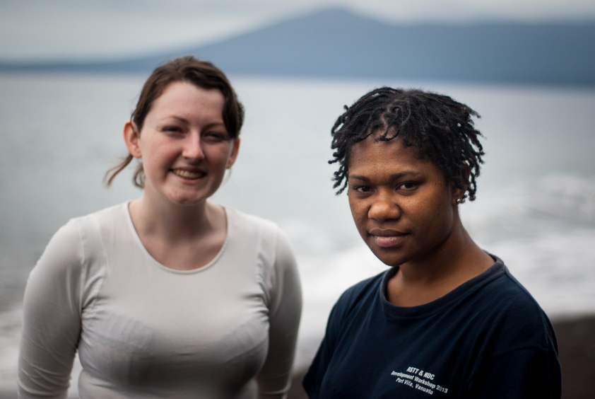
Eleri with Sandrine, the Observatory’s volcano data analyst. [Credit: Ben Clarke and Eleri Simpson]
![Sunset over camp on the southern coast of Vanuatu, it was very easy to forget you were sitting on the side of an active stratovolcano. [Credit: Ben Clarke and Eleri Simpson]](https://blogs.egu.eu/network/gfgd/files/2014/08/Leics-2.jpg)
Sunset over camp on the southern coast of Vanuatu, it was very easy to forget you were sitting on the side of an active stratovolcano. [Credit: Ben Clarke and Eleri Simpson]
We spent 5 days on the volcano trekking through relentless jungle, tripping over thick ankle-height vines, dodging fallen tree trunks, climbing up punishingly steep slopes and avoiding Nanggalat the fearsome stinging nettle. When the trees thinned the jungle floor was replaced with razor sharp A’a lava fields filled with piles of precariously balanced fragments of solid lava over which we tentatively walked. Meanwhile the crater of Lopevi overhead steamed on without so much as a quiver, indifferent to our presence. We traced the lava flows as high up the volcano as we dared, teaching Sandrine how to map them as we went. On the second day we traced a lava flow 400m up the volcano’s flank to its origin: a steep sided monogenetic cone made up of sharp scoria. Inside the cone we could see tendrils of ropey pahoehoe lava leading down the slope towards the sea. Even though the lava was solid the dynamic shapes it formed captured a picture of its past, as if we were actually watching it bubble and flow down the volcano.
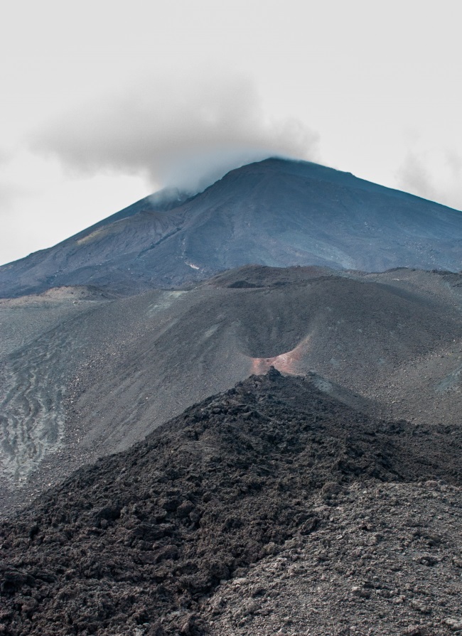
A view towards the central vent of the volcano, with a series of monogenetic cones marking the line of a fissure. [Credit: Ben Clarke and Eleri Simpson]
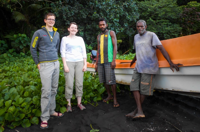
From the left: Ben, Eleri, Jimmy and Daniel (our two guides from the nearby island of Paama).
When we left Lopevi, we stayed for two more nights on Paama before our flight. Paama is a slow place where everyone walks around in bare feet, smiles at everyone they pass and never get stressed. Time is spent sitting and pondering life, a strange thing to do when accustomed to a busy life in England. But as happy as everyone is, the islanders are not without their share of troubles and hardships. Some years it does not rain enough and people are thirsty, some years it rains too much and villages are swept away by landslides. Health care is poor and there is a big problem with malaria. They are also rather isolated from the world; for example when Daniel brought his 1 year old granddaughter to see us, she cried when she saw me. Daniel later explained that she had never seen a white person before and she thought I was a ghost!
After a week away from Port Vila we returned and spent the last 2 and a half weeks working at the geohazards observatory. Firstly we produced a digitised image of what we had mapped, accompanied by a full report documenting exactly what we had done. After this we were asked to make some public information brochures detailing what to do during an earthquake, a tsunami and a volcanic eruption. We decided to split the volcanic eruption guide into 7, one for each active volcano in Vanuatu because volcanic hazards are so complex and specific to the volcano in question.
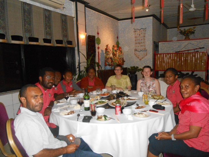
Having a meal on the final night with the Geohazards unit from the Vanuatu Geohazards Observatory.
On our last night in Vanuatu the geohazards team took us out for dinner at a Chinese restaurant where we chatted all evening to them about our plans for the future, their previous placement students and many other things. They taught us a few more phrases in Bislama like ‘Lava he come out, yumi go long boat?’ which means ‘Lava is coming out of the volcano, shall we get in the boat?’. Then they presented us with a few gifts to say thank you for our help and we said our final goodbyes.
Saying goodbye was much harder than we had expected, we had grown to really love the pace and peacefulness of Vanuatu and the people at the geohazards observatory were some of the nicest, funniest and good-natured people we have ever met. We know that we will keep in contact with them in the years to come – partly because we must know if Lopevi ever erupts again!