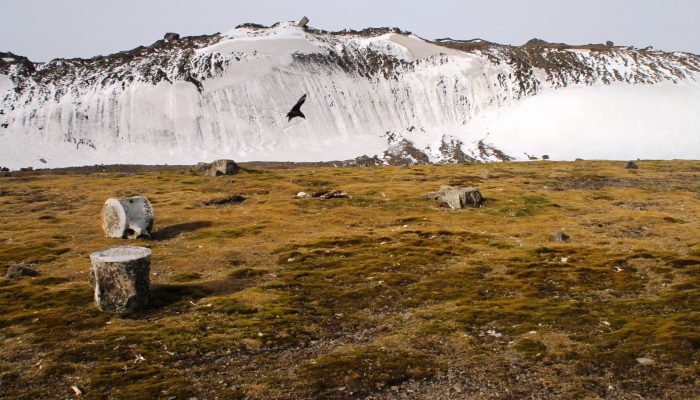
Antarctica has been known as “the frozen continent” for almost as long as we have known of its existence. It may be the only place on Earth where, instead of information on the extent of glaciers or ice caps, there exists a dataset of all non-icy areas compiled from satellite imagery.
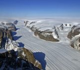
However, this repository is far from perfect: while satellite resolution and coverage have been steadily improving, Antarctica is challenging ground for remote sensing. Ice and cloud cover can be difficult to tell apart, and the low position of the sun in the sky means that long shadows can make snow, ice and rock very difficult to distinguish. As a result, the estimates of the ice-free proportion of the Antarctic continent have been vague, ranging from “less than 1%” to 0.4%.
In a new paper published in the journal The Cryosphere, scientists from British Antarctic Survey and the University of Birmingham show that the continent is even icier than previously thought. Using imagery from NASA’s Landsat 8 satellite, they find that just 0.18% of the continent are ice-free – less than half of previous estimates. This equates to an area roughly the size of Wales on a continent half again as big as Canada.
Lead author Alex Burton-Johnson and his colleagues have developed a new method of accurately distinguishing between ice, rock, clouds and liquid water on Antarctic satellite imagery. Because of the challenging nature of classifying Antarctic satellite imagery, the researchers used only the highest-quality images: they were mostly taken in midsummer, when the sun describes the highest arc in the sky and shadows are smallest, and on days with low cloud cover.
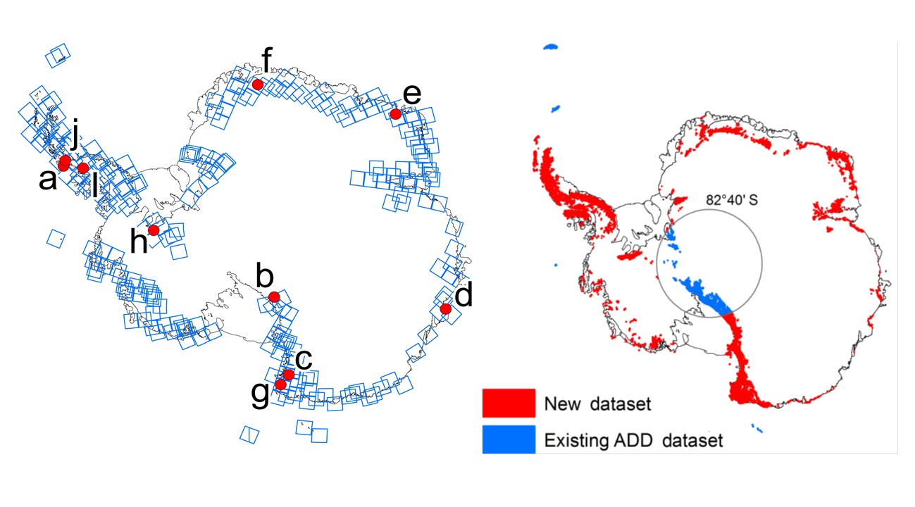
(Left) The blue squares represent the coverage of the 249 satellite images the researchers used, showing that most rocky areas in Antarctica are clustered along the coastline. The images overlap in many places, allowing for more accurate classification where some clouds occur in pictures. (Right) The new dataset for rock outcrops covers all areas marked in red. The NASA Landsat 8 satellite does not cover areas south of 82°40′ South. Islands such as South Georgia and the South Orkney Islands are too consistently cloudy during the summer period, so the new method cannot be applied here. From : Burton-Johnson et al. (2016).
The huge thickness of the Antarctic ice sheet – more than 4,000m in some places – made the scientists’ job easier: they could exclude large parts of the continent where not even the tallest peaks come close to the ice surface. A total of 249 suitably high-quality images covered those parts of the Antarctic continent that have rock outcrops.
A few locations, however, are too extreme for the new image classification method. Some of the South Orkney Islands and the subantarctic island of South Georgia are covered in heavy cloud for so much of the time even in summer that the researchers could not apply their new method. Here, they had to rely on the older dataset. They also had to exclude parts of the rugged but remote Transantarctic Mountains from the study as the Landsat 8 satellite only covers areas north of 82°40’S.
The code for the new classification methodology is available on GitHub, so that enthusiastic remote sensers can try their hand at further improving it or simply admire the frozen beauty of Antarctica from above.
By Jonathan Fuhrmann
References
Burton-Johnson, A., Black, M., Fretwell, P. T., and Kaluza-Gilbert, J.: An automated methodology for differentiating rock from snow, clouds and sea in Antarctica from Landsat 8 imagery: a new rock outcrop map and area estimation for the entire Antarctic continent, The Cryosphere, 10, 1665-1677, doi:10.5194/tc-10-1665-2016, 2016.

Pingback: Global commons | Pearltrees