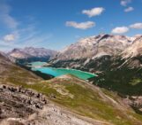
What a place to work: Spectacular views from the top of the rugged and icy peaks of Tien Shan mountain range. The desire to better understanding global climate change took Leo Sold to this remote area of Central Asia. The frozen slopes of ice and snow in today’s Imaggeo on Mondays photograph hold some of the keys to understanding how the glaciers in this remote region are being affected by a warming climate.
High altitude glacier monitoring Credit: Leo Sold (distributed via imaggeo.egu.eu)
Glacier changes are known to be excellent indicators of climatic change and are therefore monitored around the world. However, some regions have a much higher coverage of measurements than other, often remote areas. Additionally, long time-series of glacier measurements are rare even on the global scale but are indispensable for a sound data basis to study future glacier changes. Thus, having a long-term measurement series in a region like the Tien Shan is a real asset for the work of glaciologists. Central Asia has a long tradition of glacier monitoring but unfortunately many ongoing monitoring programs were interrupted in the mid-1990s after the collapse of the Soviet Union. Although the suspended time-series already provide a great source of information, their continuation is fundamental for conducting future studies on Central Asian glaciers.
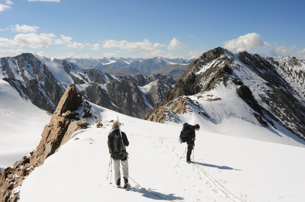
This image was taken in summer 2013 on the Suek Zapadniy glacier located in the Inner Tien Shan, Kyrgyzstan.Because snow-covered crevasses cannot always be identified at the snow surface the two researchers are roped up while taking snow depth measurements at 4500m above sea level. The monitoring of Suek Zapadniy glacier is part of the wider CATCOS project (Capacity Building and Twinning for Climate Observing Systems), which aims at improving the coverage with climate-related observations in areas were measurements are rare. It is funded by the Swiss Agency for Development and Cooperation (SDC) and is coordinated by the Swiss Federal Office of Meteorology and Climatology (MeteoSwiss). Within this project, the University of Fribourg (Switzerland) and the WGMS (World Glacier Monitoring Service) re-established a glacier monitoring programme on multiple glaciers in the Tien Shan and Pamir range in Kyrgyzstan, in close collaboration with the GFZ Potsdam (German Research Center for Geoscience, Potsdam), leading the CAWa Project (Central Asian Waters), and the Central-Asian Institute for Applied Geoscience (CAIAG) located in Kyrgyzstan. Notably, the project also focuses on capacity building – meaning, field campaigns involve on-site training of researchers in Kyrgyzstan and Switzerland.
The subset of glaciers chosen for the monitoring program is based on the availability of previous or historical data, the accessibility, and their distribution across the region. Annual mass balance measurements have been carried out since the summer of 2010. Their aim is to establish the difference between the amount of snow that is accumulated on the glacier during winter and the amount of ice melted during the summer months. Integrated over the entire glacier area, this provides a measure for the mass change of a glacier and, thus, for its response to climate changes. In the low-altitude areas of a glacier where summer melting exceeds the quantity of snow accumulated in winter, mass balance measurements involve drilling and maintenance of ablation stakes. These stakes are commonly made of plastic and are inserted into the glacier at a known depth, providing a bench mark against which the glacier thickness changes can be measured. In high altitudes snow can outlast the entire year, allowing the glacier to gain mass. The accumulation is measured as snow depth and its density by means of digging snow pits. Together, ablation and accumulation measurements provide the glacier mass balance. Since 2010 Suek Zapadniy glacier loses 0.4m water equivalent each year, referring to the water level if snow and ice was melted and distributed over the glacier.
“Ideally, summer measurements at the end of the hydrological year would be complemented by winter accumulation measurements in spring. However, reaching such remote areas involves an immense logistical effort under difficult conditions,” explains Leo.
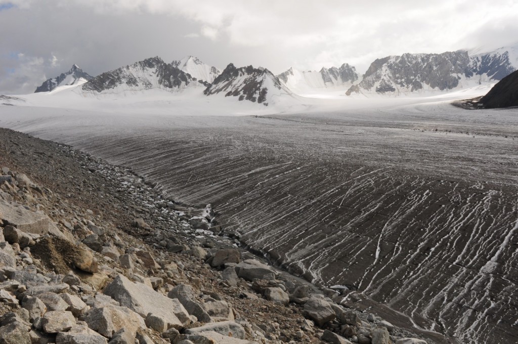
Black Abramov glacier. Before the fall of the Soviet Union, Abramov glacier provided one the the longest continuous glacier mass balance records, dating back to 1968. In 2011, a global research network re-established a monitoring program in cooperation with local partners. The picture highlights the important role of surface albedo in terms of glacier ablation. Credit: Leo Sold (distributed via imaggeo.egu.eu
By Laura Roberts, EGU Communications Officer and Leo Sold, PhD Student at the University of Fribourg
If you pre-register for the 2015 General Assembly (Vienna, 12 – 17 April), you can take part in our annual photo competition! From 1 February up until 1 March, every participant pre-registered for the General Assembly can submit up three original photos and one moving image related to the Earth, planetary, and space sciences in competition for free registration to next year’s General Assembly! These can include fantastic field photos, a stunning shot of your favourite thin section, what you’ve captured out on holiday or under the electron microscope – if it’s geoscientific, it fits the bill. Find out more about how to take part at http://imaggeo.egu.eu/photo-contest/information/.