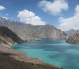
In a true feat of endurance, self-discovery and resilience, Solmaz Mohadjer and Josy Strunden, geology students at the University of Tübingen (Germany), cycled 800 km in the Pamir Mountains as part of a trip to raise awareness about autism in Tajikistan. ““We cycled through one of the most tectonically active regions on the planet, passing by mountain communities that welcomed us warmly as well as ancient fortresses, hermit caves, Buddhist stupas, hot springs, and geologic wonders such as the Stone Flower” describes Solmaz.
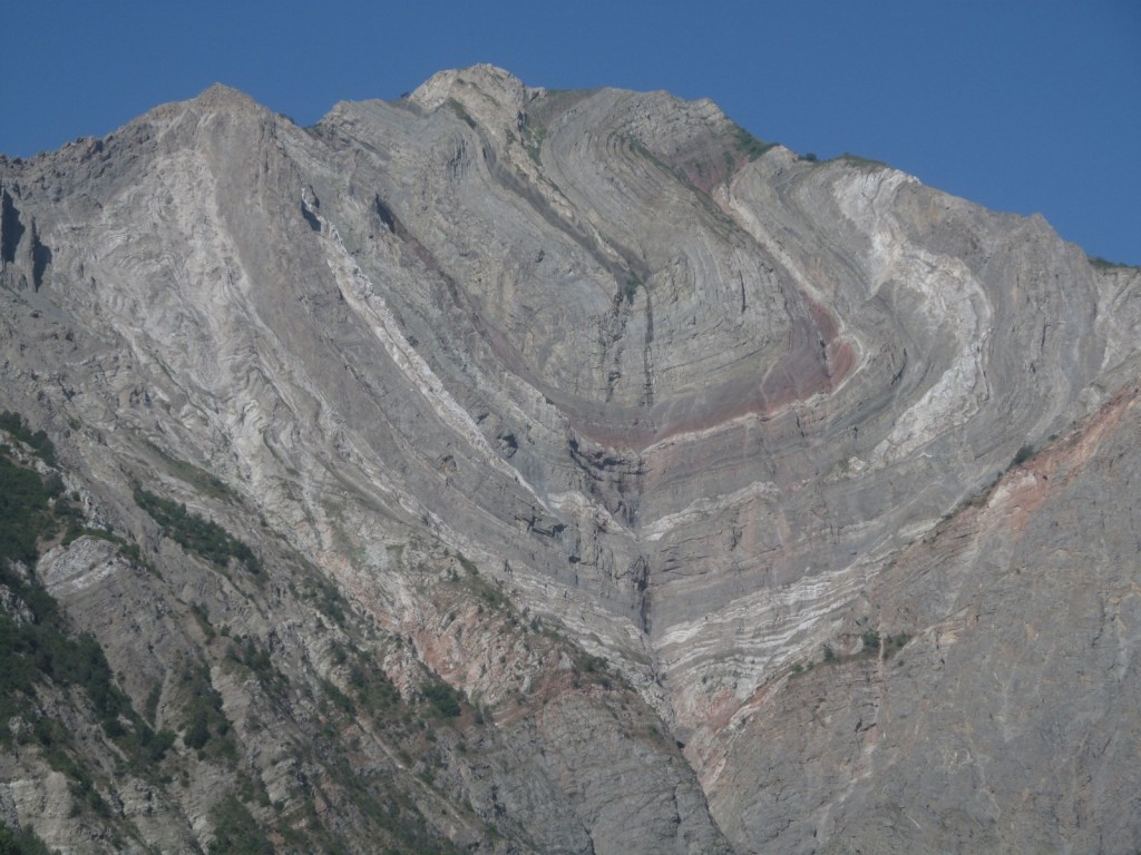
Stone Flower. (Credit: Solmaz Mohadjer, via imaggeo.egu.eu)
Central Asia is home to the mighty Himalayas, Tian Shan, Karakoram, Kunlun and Hindu Kush mountain ranges. Where these all meet you find the less well known, but no less impressive, Pamir Mountains. The range includes some peaks in excess of 6000m which combined with high undulating grasslands of the eastern portion of the mountains (which in the local language are known as pamirs) means this region has been known as the “Roof of the World” since Victorian times. The precise extent of the mountains is highly debated but the bulk of the range spans the territories of Tajikistan, Afghanistan and Kyrgyzstan.
Much like the Tibet orogen, the Pamir Mountains result from the collision of the Indian and Eurasian Plates 40 to 50 million years ago, during the Eocene, leading to the closing of the Tethys Sea. Similarly to the Tibetan peaks, the Pamir Mountains are characterised by a thick crust (up to 65 km) with an extensive plateau. The high peaks of the Pamirs are the result of up to 2100 km of shortening which is ongoing today as India continues to travel northwards pushing into the Eurasian plate.
Geologically the Pamir Mountains can be divided into three broad zones (or belts) which mainly encompass gneisses of a variety of ages. The southern zone is dominated by ancient Precambrian (more than 540 million years old) metamorphic rocks including marbles and quartzites. Younger limestones, sandstones and shales of Jurassic, Triassic, and Permian ages (about 300 to 145 million years ago) form the central zone. The northern most Pamirs are the most geologically complex and the deformation history is the hardest to unravel given that the force of the collision between the two tectonic plates thrusts old rocks up and over younger ones forming structures known as overthrusts.
This disharmonic fold in our Imaggeo on Mondays photograph, found in the complex northern Pamirs, is the result of the intense squeezing of the rocks as the two tectonic plates converge. It is formed of three layers of rocks with very different properties: a soft layer of limestone and marl is sandwiched between slightly tougher sandstones and conglomerates. This means the rocks do not bend uniformly when squeezed and so form the beautiful structure in the stone flower.
The ongoing movement of the plates means this area is seismically active, registering in excess of 2500 earthquakes a year. Whilst the earthquakes themselves remain the primary hazard in the region, rockfalls triggered by the seismic activity and mudflows, as well asflash floods resulting from severe storms also create a major natural hazard. Solmaz is attempting to quantify and better understand the hazards associated with high mountains, in particular earthquakes and rockfalls, so it is not surprising that she has a keen interest in this part of the world. In addition, she is passionate about educating local communities about regional geohazards and helping them increase their resilience to the adverse effects they can potentially have on everyday life.
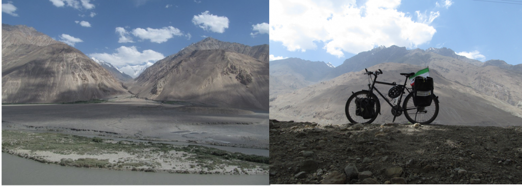
Image on left (alluvial fan and Hindu Kush) was taken somewhere along the Wakhan Corridor (Credit: Solmaz Mohadjer, via imaggeo.egu.eu). The image on the right was taken in a villages called “Yakhshwol” in the Wakhan Corridor (Credit: Solmaz Mohadjer).