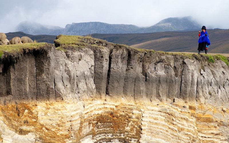
Paramo Soil. (Credit: Martin Mergili,via imaggeo.egu.eu)
What lies between 3000m and 4800m above sea level in the mountains of the Andes? A very special place dominated by an exceptional ecosystem: The Páramo. Picture lush grasslands with a unique population of flora and fauna, some of which is found nowhere else on Earth.
Páramos stretch from Ecuador to Venezuela, across the Northern Andes and also occur at high elevation in Costa Rica. The climate here is changeable; dowsing rains can be immediately followed by clear skies and blazing sunshine. Overall, the areas experience low average temperatures and rates of evaporation but moderate amounts of precipitation. It is this changeable climate that means the Páramo is thought to be an evolutionary hot spot, where biodiversity is budding faster than at any other place on Earth.
However, were it not for the traditional Andean clothing the girl is wearing in our Imaggeo on Monday’s image, you wouldn’t immediately know this photograph was taken close to the equator. Martin Mergili visited the Páramos of Ecuador, back in 2007, as a PhD student of the University of Innsbruck (Austria) on a field trip around the South American country. Martin gives a detailed account of how the Páramo soil pictured in the image came to be:
‘Whilst 100 km to the east, in the lowlands of the Amazon rainforest, organic matter is rapidly decomposed and soils may be tens of metres deep due to extensive weathering, the reverse is the case here, 3000 m higher up. In the tropical highlands of the Páramo, the year round moist and cool regime slows decomposition and weathering. The obvious result is a rather peaty soil, rich in organic content, supporting pasture grounds used for herding sheep.’
The Páramos support the local human population by providing the main source of water in the Andean valleys whilst the grasslands provide extensive fodder for grazing cattle or sheep. To provide fresh appetising grasses farmers regularly burn the natural vegetation. To what extent the soil of the Páramos is altered as a result of this practice is not clear, but it might provide an explanation for the presence of the dark grey layer seen in the photograph.’Alternatively’, explains Martin, ‘as the area is influenced by significant volcanic activity, this layer might well be the result of ash falls.’
A further feature of interest is the sequence of undulating layers below the organic soil: still part of the soil, it represents a set of volcanic or sedimentary strata with varying resistance to weathering and erosion, probably influenced by tectonic forces. A metre below the bottom of the image, you would come across unweathered rocks.
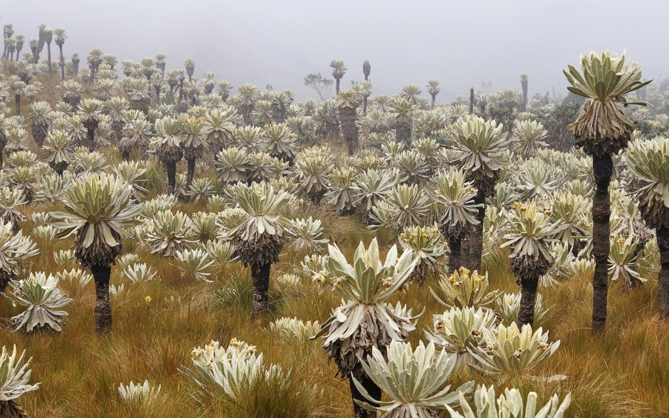
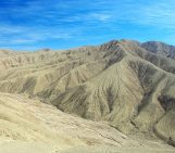
Páramo El Ángel in Ecuador with Espeletia plants (Credit: Martin Mergili via http://www.mergili.at/worldimages/)
By Laura Roberts Artal, EGU Communications Officer and Martin Mergili, BOKU University, Vienna
References
Buytaer. W., Sevink. J., De Leeuw. B., Deckers. J.: Clay mineralogy of the soils in the south Ecuadorian paramo region, Geoderma, 127, 144-129, 2005
Hofstede. R. G.M.: The effects of grazing and burning soil and plant nutrient concentration in Colombian paramo grasslands, Plant and Soil, 173, 1, 111-132, 1995
Imaggeo is the EGU’s open access geosciences image repository. Photos uploaded to Imaggeo can be used by scientists, the press and the public provided the original author is credited. Photographers also retain full rights of use, as Imaggeo images are licensed and distributed by the EGU under a Creative Commons licence. You can submit your photos here.
Pingback: GeoLog | Geosciences Column: Do roads mean landslides are more likely?