A geologist out in the field is often the one doing the mapping, but sometimes you might just find a map while you’re out there. Martin Reiser shares how he stumbled one such stunning feature…
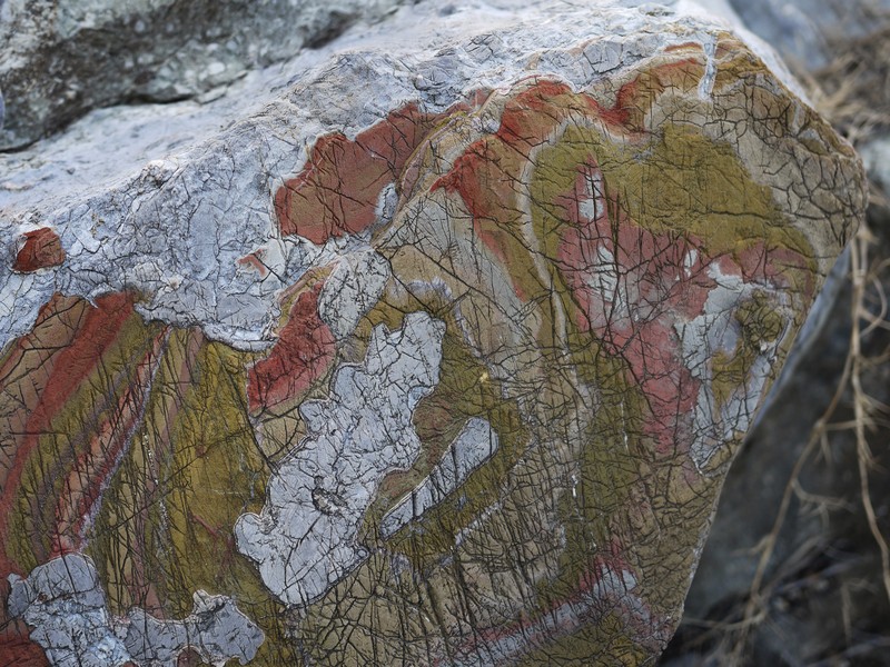
Oxidised and eroded limestone layers, resembling patterns of a geological map. (Credit: Martin Reiser, distributed via imaggeo.egu.eu)
The picture shows colourful marly layers in a Triassic limestone of northwest Albania (Lezhe region). The marly layers have developed intense reddish and greenish colours due to exposure to reduction and oxidation processes (redox-conditions). Subsequent partial erosion has then exposed different levels of these coloured layers and created a pattern resembling a geological map with horizontal layering. Although it might look artificial or even painted, the colours of the rock were really that intense!
The map-like pattern caught my eye when we visited that outcrop during a fieldtrip to Albania in 2011. The fieldtrip was organised by the University of Berlin to study the geology of Albania and specifically focused on the regional tectonic evolution from the Jurassic until the present.
By Martin Reiser, University of Innsbruck
Imaggeo is the EGU’s open access geosciences image repository. Photos uploaded to Imaggeo can be used by scientists, the press and the public provided the original author is credited. Photographers also retain full rights of use, as Imaggeo images are licensed and distributed by the EGU under a Creative Commons licence. You can submit your photos here.