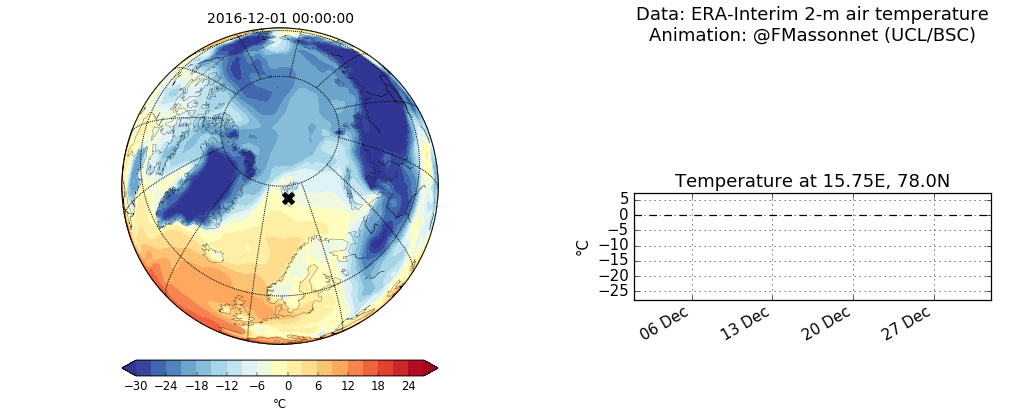
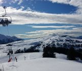
Fig. 1: (Left) Evolution of 2-m air temperatures from a reanalysis over December 2016. (Right) Time series of temperature at the location of the black cross (Svalbard). Also shown is the 1979-2000 average and one standard deviation (blue). [Credit: François Massonnet ; Data : ERA-Interim]
The winter 2016-2017 has been one of the hottest on record in the Arctic. In our Image of the Week, you can see that air temperatures were positive in the middle of the winter! Let’s talk about the reasons and implications of this warm Arctic winter. But first, let’s take a tour in Svalbard, the gateway to the Arctic…
A breach in the one of the world’s largest seed vaults
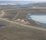
The Global Seed Vault on Svalbard (located at the black cross in our Image of the Week) is one of the world’s largest seed banks. Should mankind face a cataclysm, 800,000 copies of about 4,000 species of crops can safely be recovered from the vault. Buried under 120 m of sandstone, located 130 m above sea level, and embedded inside a thick layer of permafrost, the vault can withstand virtually all types of catastrophe – natural or man-made. This means, for example, that it is high enough to stay above sea level in case of a large sea-level rise, or that it is far enough from regions that might be affected by nuclear warfare. But is it really that safe? Last winter, vault managers reported water flooding at the entrance of the cave, after an unexpected event of permafrost melt in the middle of polar night. Not enough to put the seeds at risk (they are safely guarded in individual chambers deeper in the mountainside), but worrying enough to raise concern about how, and why such an event happened…
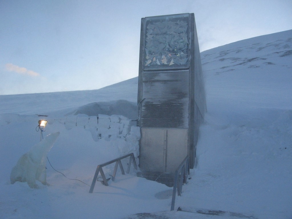
Fig. 2: Entrance of the Svalbard Global Seed Vault. [Credit: Dag Terje Filip Endresen, Wikimedia Commons ].
Soaring temperatures in the Arctic
The Arctic region is often dubbed the “canary in the coal mine” for climate change: near-surface temperatures there have risen at twice the pace of the world’s average, mainly due to the process of “Arctic Amplification“ whereby positive feedbacks enhance greatly an initial temperature perturbation. Increases in lower-troposphere Arctic air temperatures have occurred in conjunction with a dramatic retreat and thinning of the sea-ice cover in all seasons, a decrease of continental spring snow cover extent, and significant mass loss from glaciers and ice sheets (IPCC, 2013)
Winter temperatures above freezing point
The last two winters (2015-2016 and 2016-2017) have been particularly exceptional. As displayed in our Image of the Week for winter 2016-2017 and here for 2015-2016 (see also two news articles here and here for an accessible description of the event), temporary intrusions of relatively warm air pushed air temperatures above freezing point in several parts of the Arctic, even causing sea ice to “pause” its expansion at a period of the year where it usually grows at its fastest rate (see Fig. 3).
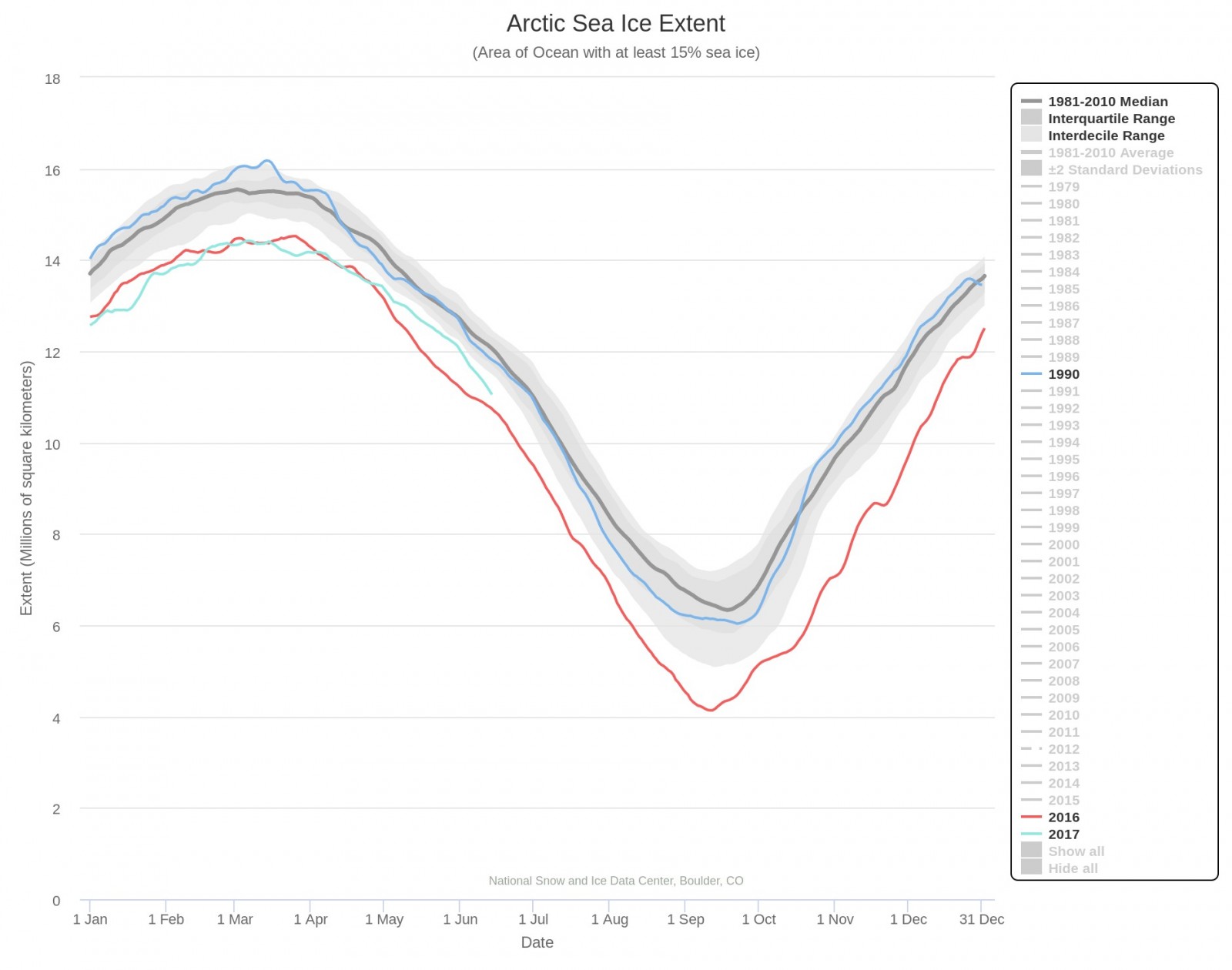
Fig.3 : Mean Arctic sea ice extent for 1981 to 2010 (grey), and the annual cycles of 1990 (blue), and 2016-2017 (red and cyan, respectively). [Credit: National Snow and Ice Data Center. Interactive plotting is available here ]
Cullather et al. (2016) and Overland and Wang (2016) conducted a retrospective analysis of the 2015-2016 extreme winter and underlined that the mid-latitude atmospheric circulation played a significant role in shaping the observed temperature anomaly for that winter (see also this previous post). Scientists are still working to analyse the most recent winter temperature anomaly (2016 – 2017).
Unusual?
How unusual are such high temperatures in the middle of the boreal winter? It is important to keep in mind that the type of event featured in our Image of the Week results from the superposition of weather and climate variability at various time scales, which must be properly distinguished. At the synoptic scale (i.e., that of weather systems, several days), the event is not exceptional. For example, a similar event was already reported back in 1975! It is not surprising to see low-pressure systems penetrate high up to the Arctic.
At longer time scales (several months), the observed temperature anomaly in the recent two winters is more puzzling. The winter 2015-2016 configuration appears to be connected with changes in the large-scale atmospheric circulation (Overland and Wang, 2016). To understand the large-scale atmospheric circulation, scientists like to map the so-called “geopotential height” field for a given isobar, that is, the height above sea level of all points with a given atmospheric pressure. The geopotential height is a handy diagnostic because, in a first approximation, it is in close relationship with the wind: the higher the gradient in geopotential height between two regions, the higher the wind speed at the front between these two regions. The map of geopotential height anomalies (i.e., deviations from the mean) for the 700 hPa level in December (Fig. 4) is suggestive of the important role played by the large-scale atmospheric circulation on local conditions. The link between recent Arctic warming and mid-latitude atmospheric circulation changes is a topic of intense research.
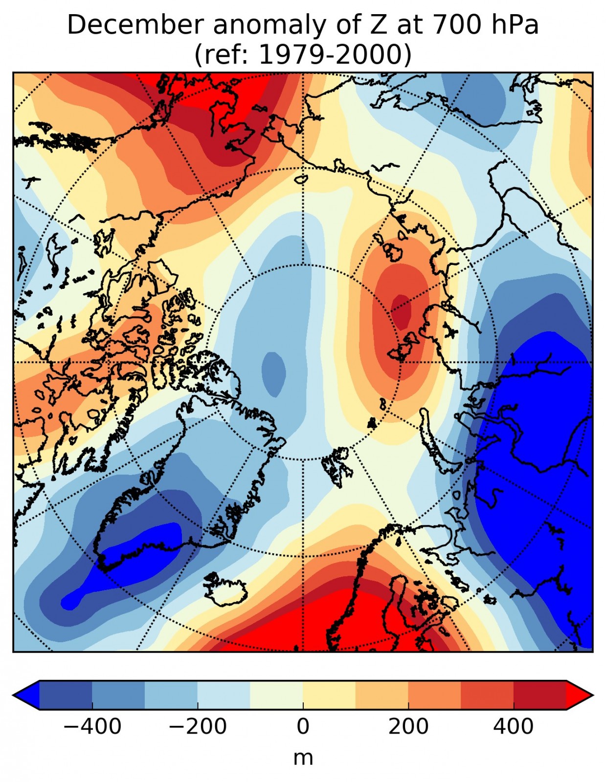
Fig.4: Anomaly in 700 hPa geopotential height, December 2016 (with regard to the reference period 1979-2000) [Credit: François Massonnet; Data: ERA-Interim]
Finally, at climate time scales (several years to several decades), this event is not so surprising: the Arctic environment has changed dramatically in the last few decades, in great part due to anthropogenic greenhouse gas emissions. With a warmer background state, there is higher probability of winter air temperatures surpassing 0°C if synoptic and large-scale variability positively interact with each other, as seems to have been the case during the last two winters.
What does this mean for future winters?
The rapid transformation of the Arctic is already having profound implications on ecosystems (Descamps et al., 2016) and indigenous populations (e.g., SWIPA report). To a larger extent, it can potentially affect our own weather: we polar scientists like to say that “what happens in the Arctic, does not stay in the Arctic”. The unusual summers and winters that large parts of Europe, the U.S. and Asia have experienced in recent years might be related to the rapid Arctic changes, according to several scientists – but there is no consensus yet on that matter. One thing is known for sure: the last two winters have been the warmest on record, but this might just be the beginning of a long chain of more extreme events…
Further reading
- Overland, J.E. and M. Wang, 2016: Recent Extreme Arctic Temperatures are due to a Split Polar Vortex. J. Climate, 29, 5609–5616, doi: 10.1175/JCLI-D-16-0320.1
- Cullather, R.I., Y.-K. Lim, L.N. Boisvert, L. Brucker, J.N. Lee, and S.M.J. Nowicki (2016): Analysis of the warmest Arctic winter, 2015-2016, Geophys. Res. Lett., 43, 10, 808-10,816, doi: 10.1002/2016GL071228
- Image of the Week – Climate Change and the Cryosphere
- Image of the Week – The ups and downs of sea ice
-
Image of the Week – When the dirty cryosphere destabilizes
Edited by Scott Watson and Clara Burgard

François Massonnet is a F.R.S.-FNRS Post-Doctoral Researcher at the Université catholique de Louvain and affiliated at the Barcelona Supercomputing Center (Spain). He is assessing climate models as tools to understand (retrospectively and prospectively) polar climate variability and beyond. He tweets as @FMassonnet. Contact Email: francois.massonnet@uclouvain.be
